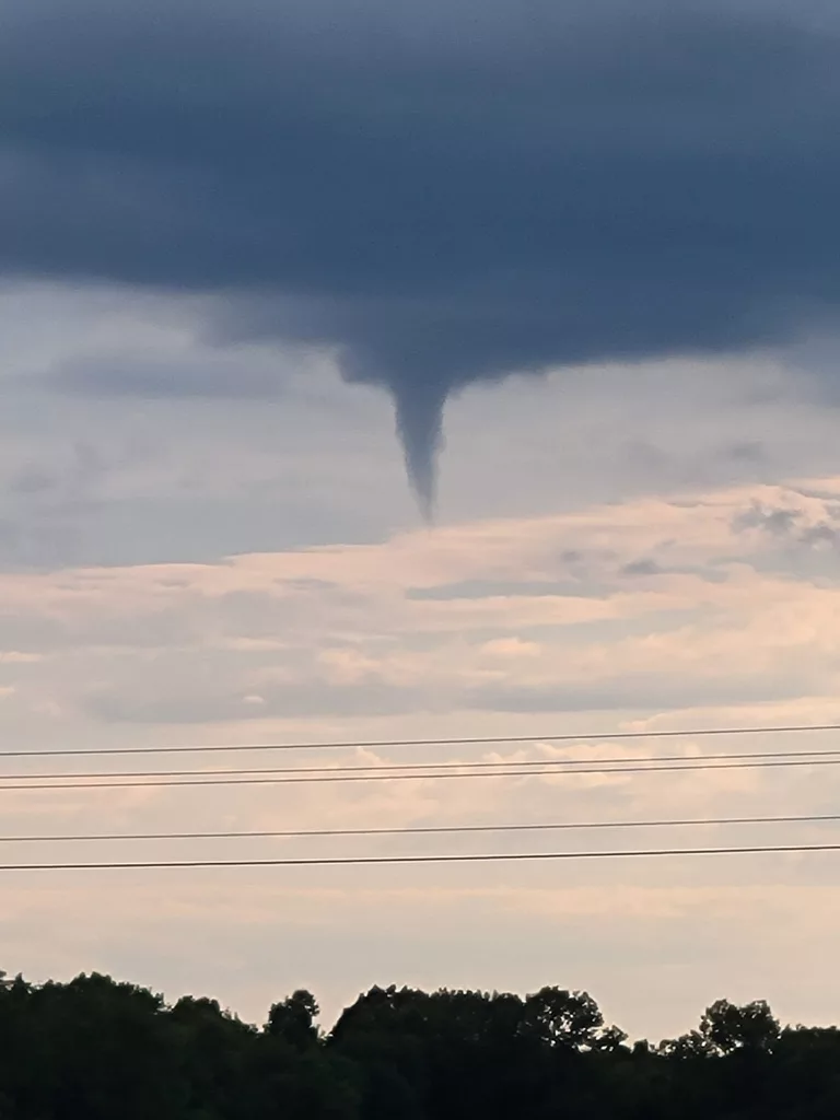


Good morning everyone! Last week we saw many reports of funnel clouds in the West Central Missouri area. These were confirmed cold air funnels. Cold air funnels look scary, but most of the time they are harmless. On occasion they can touch down and become a tornado, producing winds around 85 miles per hour which would be an EF-0. They are called cold air funnels because they form when a colder push of air moves in over top a warm surface, making the environment unstable. Instability is a term which classifies how likely the air is to rise. In order for the air to rise you have to have warmer air below a cooler layer aloft. If a parcel of air is warmer than its environment then it can rise and eventually produce a cloud. Just so happens we had warm air at the surface on that Sunday with a cold upper level low moving in from the west. Also, tornadoes that you typical see in strong storms fall from a much more ominous looking cloud, called a wall cloud. Cold air funnels on the other hand typically have a different kind of parent cloud. The cold air funnels we saw in WCMO lowered from almost stratus looking clouds. In the case of a cold air funnel touching down and becoming a tornado you would want to go indoors and get away from windows. Cold air funnels are also very hard to detect on radar. Large tornadoes typically look like kidney beans on radar and have a hook on them. But remember, cold air funnels very rarely ever touch the ground to cause any damage. Subby (picture from Subby’s Weather Talk courtesy of Jeremy Fly)