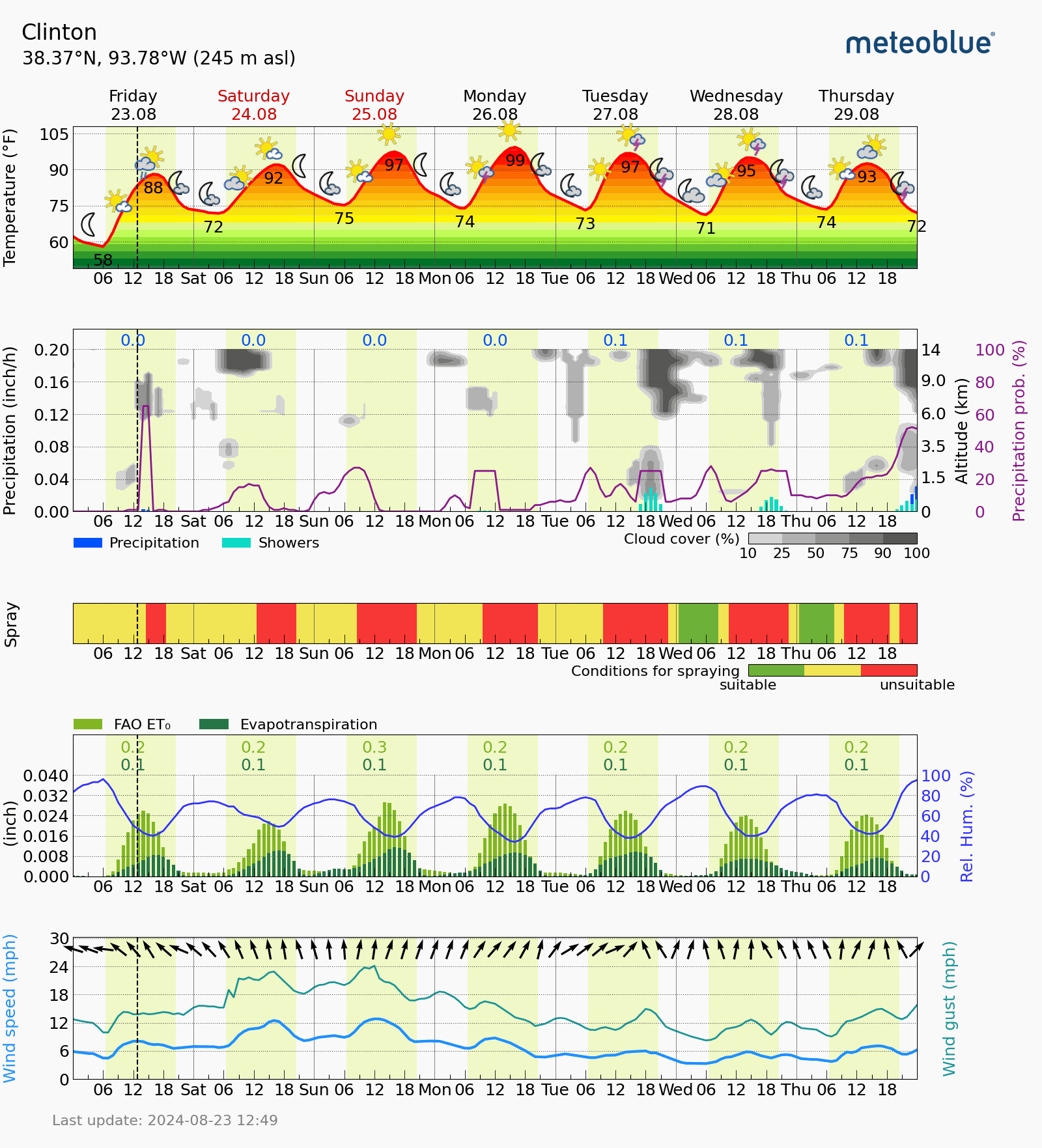


We are really needing some rainfall here in West Central Missouri. The temperatures are expected to warmup this weekend, lasting through around Thursday of next week. A weak disturbance will be making its way into the Central US, giving us a chance on Saturday morning of a few scattered showers/thunderstorms. We sure could use them. Our next chances of moisture come as a cold front moves in sometime next Thursday into Friday, dropping our temperatures as well. Here is the latest from Brad Rippey, Ag Meteorologist USDA as well as our local Agricultural Meteogram;
Agricultural Weather Highlights
In the West, the monsoon circulation remains active, with scattered showers dotting the Four Corners States. Meanwhile, showers associated with a Northwestern disturbance are generally affecting Oregon and Washington. Between the two
areas of unsettled weather, a significantly elevated wildfire threat across portions of the Great Basin and Intermountain West is due to gusty winds and low humidity levels.
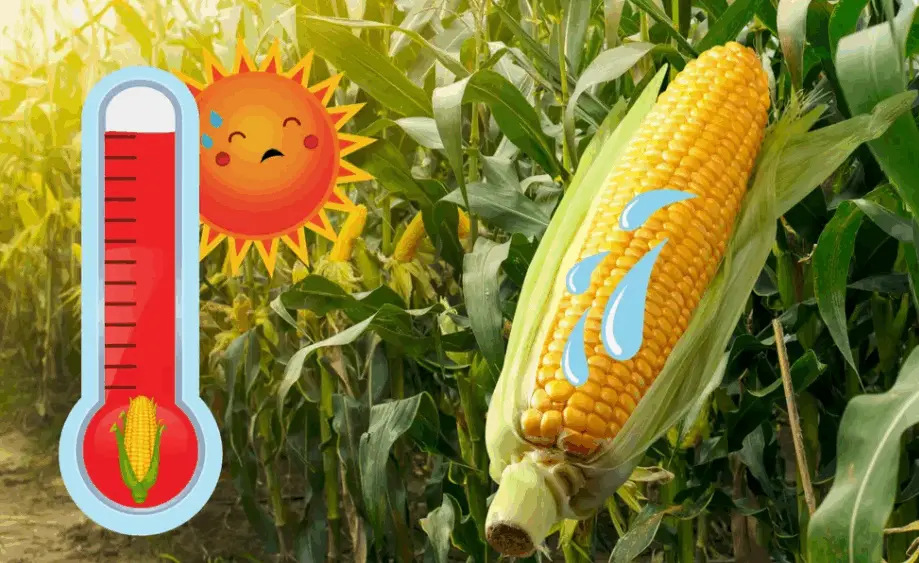
On the Plains, dry weather and record-breaking high temperatures across portions of Oklahoma and Texas are
maintaining stress on rangeland, pastures, and immature summer crops. Farther north, however, beneficial showers are occurring on the central Plains. Meanwhile, another area of hot weather, focused across the northern Plains, favors small grain maturation and harvesting. By August 18, thirty percent of the U.S. barley acreage had been harvested.
In the Corn Belt, mostly sunny weather is helping to push Midwestern summer crops toward maturity. By August 18, five percent of the U.S. corn crop was fully mature. On the same date, USDA/NASS reported that topsoil moisture was rated at least one-half adequate in all Midwestern States except Ohio, led by Missouri and Wisconsin at 81% adequate.
In the South, mostly dry weather favors summer crop maturation and harvesting. On August 18, the Southern corn harvest—among reporting states—ranged from 13% complete in Alabama to 60% complete in Texas. Early today, any rain is primarily falling across Florida and adjacent areas along the southern Atlantic Coast.
Outlook: Hone, the first tropical cyclone to form over the Central Pacific Ocean since October 2019, is currently centered about 700 miles east-southeast of Hilo, Hawaii, moving westward at 14 mph. The tropical storm, with sustained winds near 45
mph, may strengthen before passing just south of Hawaii’s Big Island late Saturday into Sunday. Storm impacts on the Big Island could include excessive rainfall, gusty winds, and heavy surf. Meanwhile on the U.S. mainland, most of the significant rain over next few days will fall across the Four Corners States, associated with the Southwestern monsoon circulation; from the Pacific Northwest into the upper Midwest, in conjunction with a cold front; and across the lower Southeast, where disorganized tropical moisture is lurking. Elsewhere, heat will briefly surge northeastward from the south-central U.S., temporarily reaching the Corn Belt late in the weekend and early next week. The NWS 6- to 10-day outlook for August 28 –September 1 calls for the likelihood of near- or above-normal temperatures nationwide, except for cooler-than-normal conditions across northern sections of the Rockies and High Plains. Meanwhile, near- or above-normal rainfall across much of the country should contrast with drier-than-normal conditions from the Pacific Northwest to Montana and in the Mississippi
Delta and environs.