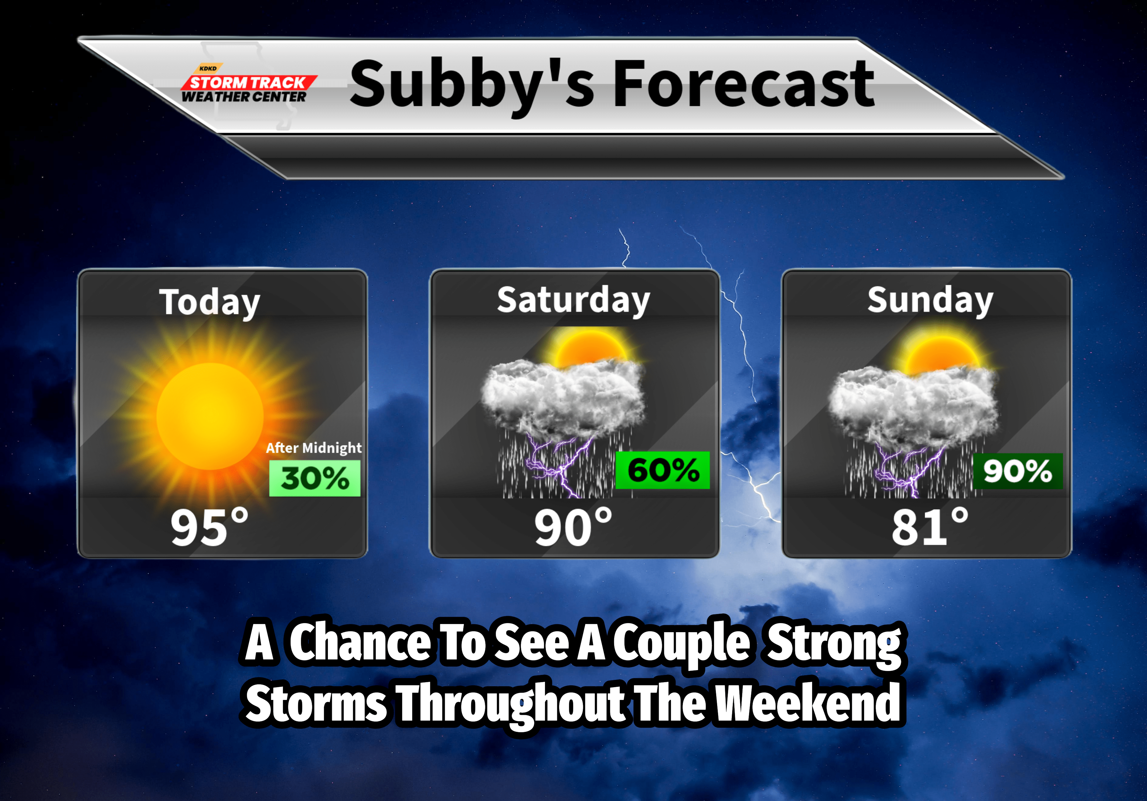
A few locations in West Central Missouri picked up anywhere between .50″ to 1″ of rainfall last night. Those reports were mainly isolated in Bates, Cass and Vernon Counties. We have several more chances to see thunderstorms over the next 3 days. We actually have a flash flood risk for Sunday, as multiple rounds of rain and thunderstorms are expected to roll through our area. We may even have a few areas pick up 2-3″ of rain fall on Sunday! As long as it is spread out over a few hours and not all in 10 minutes would be great…….I am watching for the potential to see some stronger storms on Saturday night and especially on Sunday. I will be continuing to update as we go into the weekend. Friday Night Lights look good tonight with hot conditions but no storms expected during the games. The Friday Night Lights Forecast will be coming out around 2-3pm. Have a great weekend!