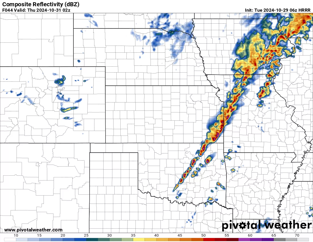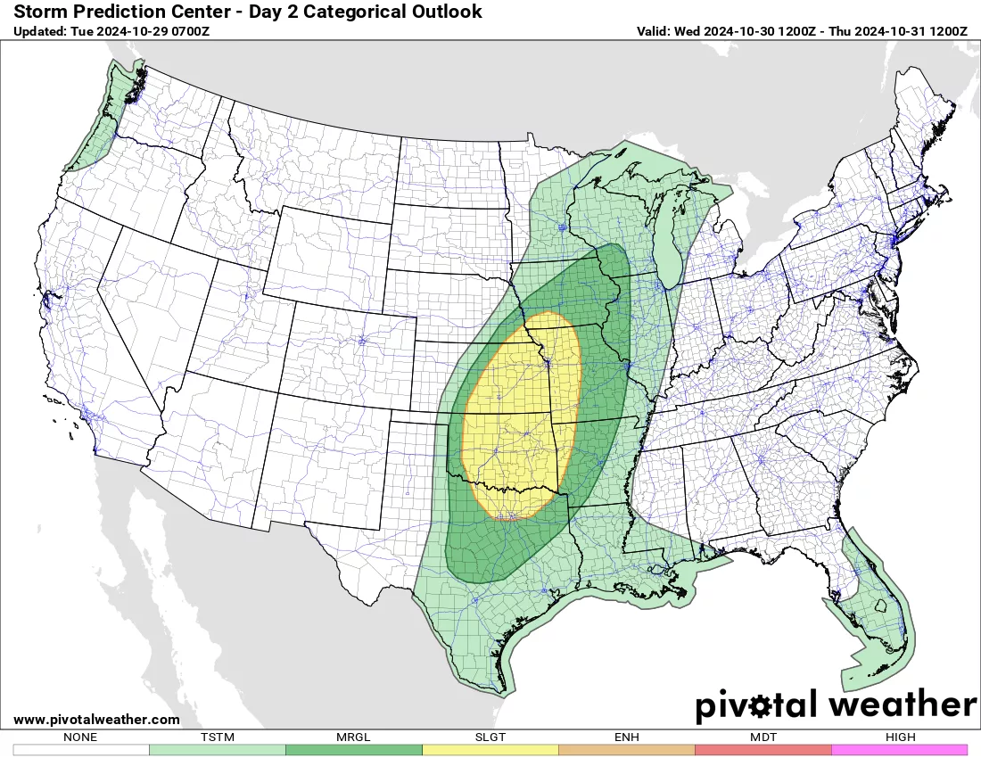
Good Tuesday morning everyone! We will see wind gusts 40-50 mph today in West Central Missouri out ahead of a potent Low Pressure System. Please, no outdoor burning today! This system is showing to impact our area on Wednesday evening with showers and thunderstorms, in which some may be strong to severe. The latest data shows a line of intense thunderstorms marching across WCMO around the 9pm time-frame (picture 1). Our biggest threats are going to be strong straight line winds and a few hail reports of quarter size or larger. We will have a slight chance to see an isolated tornado along the leading edge of this line of storms. Of course I will be be here live with you guys through out the duration of these storms. Halloween still looks good with cooler temperatures and dry conditions. Rain moves back in Saturday morning into our area through the weekend and into next week. We could see another chance for strong storms on Election Day, so lets keep an eye on the updates. All of West Central Missouri is in line to see 3-6″ of rainfall by next Wednesday, with locally higher pockets of totals. The second picture is the Storm Prediction Center’s risk assessment for the threat of severe weather on Wednesday and you can see that our area is under the “Slight” chance bubble. We may see an upgrade in that assessment later on today. Subby