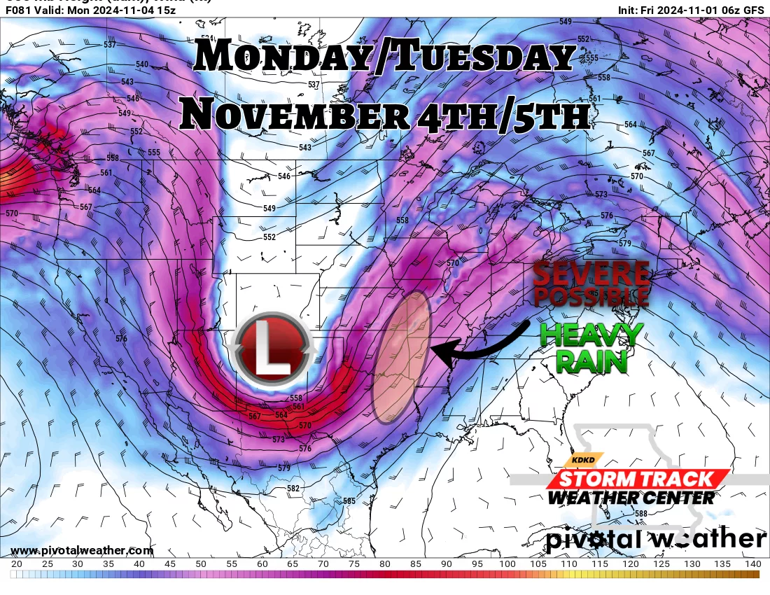
Good morning! I am hoping everyone had a safe and wonderful Halloween with lots of candy and potatoes! We will begin to be affected by system number 2 on Saturday afternoon/evening with rain and thunderstorms moving into West Central Missouri. We will see several rounds through Tuesday. After analyzing all the model data, I think our severe chances will remain in check until Monday into Tuesday. A very strong Low Pressure system will dip down into New Mexico then eject up into the Midwest putting WCMO into the favorable area to receive heavy rains and the possibility to see some strong to severe thunderstorms (picture below). Flooding may even become a problem along Big Creek and the Grand River through this time period, especially after the rounds of rain from Saturday and Sunday already saturating the soil. Currently, data suggest an additional 3″ to 6″ of rainfall through Tuesday will isolated areas receiving 6″ to 10″ of rain. What an incredible cycle we start with utilizing the LRC. These storm systems are stacked up out in the Pacific with storm system number 3 right behind this one that will affect us next Thursday into the weekend. The days for the drought in West Central Missouri are definitely numbered. Subby