


Good morning everyone! The Storm Prediction Center has put out a Day 6 Severe Threat over Saturday night into Sunday. This will likely be another nocturnal threat for most of our area. It has shifted a bit more east over the last few runs of the data. The big storm doesn’t really get its act together until it has mostly passed WCMO. That puts the same area as last week under the gun; SW and SE Missouri, Western Ill, Arkansas. 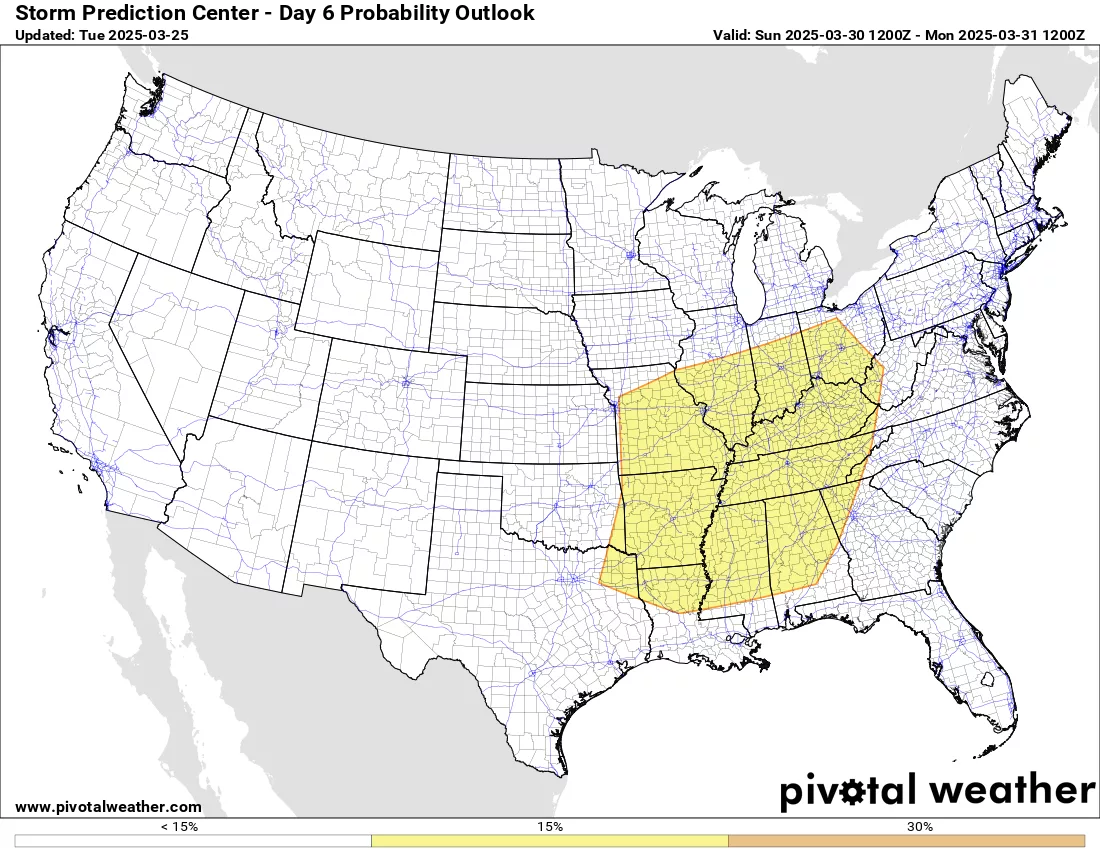
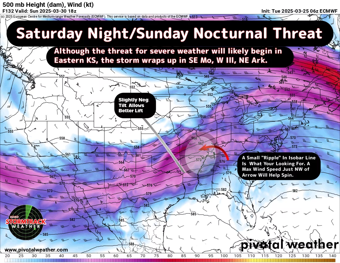
The severe threat will likely begin in Eastern Kansas Saturday night and the potential does exist for isolated severe thunderstorms there and into WCMO. As the system moves further east, it will tap into little better ingredients and should ramp up over central Mo into SE Mo. Using the 500mb model map, I have highlighted the circled area as the biggest tornado threat area as of today. This WILL change as we get closer;
We need to keep weather aware for Saturday and keep up on updates. As this storm makes landfall on the West Coast and get some higher resolution data coming in, we will have a better idea on where this bad boy will go as we get closer to Thursday and Friday. Enjoy the beautiful weather today and tomorrow, as we have some rain moving in for Wednesday night and for Thursday. Subby

