
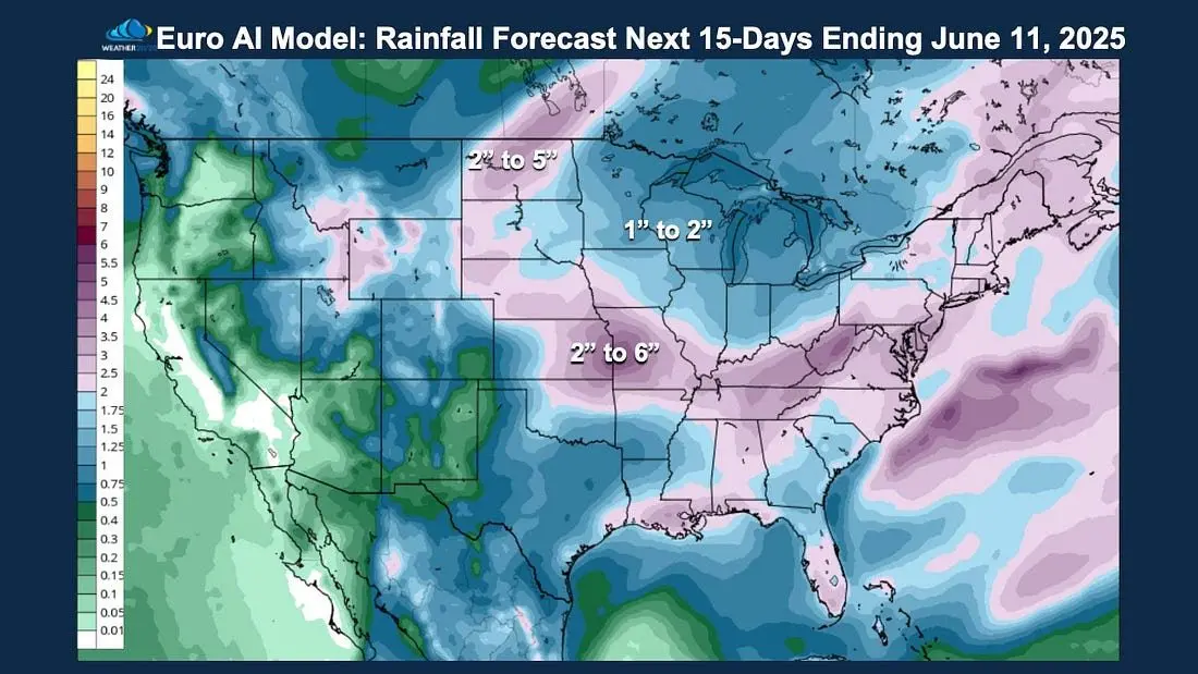
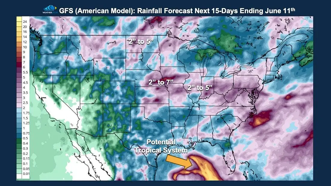
Good morning everyone! Over the past 30 days, much of the central US has benefited from well-timed, meaningful rainfall. West Central Missouri is not under any kind of drought index criteria, which is a first for a very long time. This pattern is continuing as we we are heading into the active period of the LRC cycle. All the cooler air has helped slow evaporation as well, keeping the fields nice and moist. Both the GFS and ECMWF AI models are showing widespread rainfall over 2″ or more across WCMO over the next couple weeks. There is a tropical system that the models try and show as well down in the GULF! (Pic 1 and 2 Below)
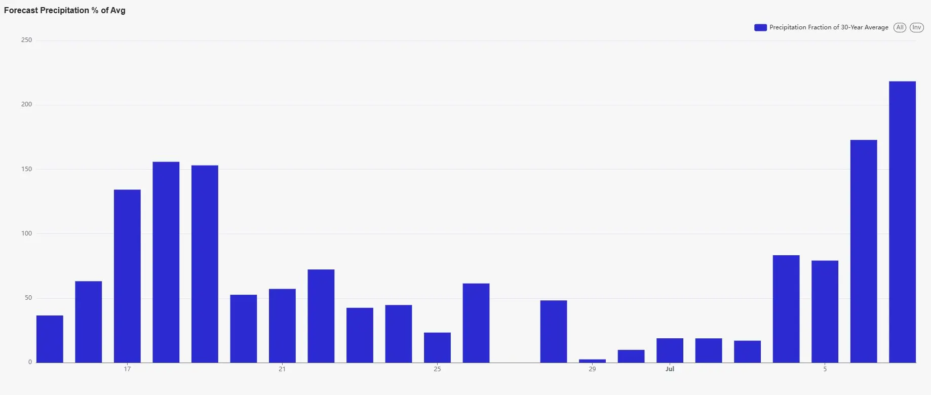
So the LRC is showing 2 larger storm systems with potential severe weather coming in for June. One for around the 5th-9th and another one around the 16th-19th. Then after that, our severe storm season will really be winding down, as the Jet Stream retreats north and give those in the upper Great Plains and Canada their start of severe storm season. Here is a look at the dashboard day by day starting with our storm system around the 15th-18th. Week up to July 4th looks good, with a storm system coming in around the 5th of July. As Subby’s Weather Talk being a partner with Weather 20/20 and the LRC, I can offer discounts on products that Gary Lezak and his group offers. Let me know if you have any interest in any of the products such as Global Predictor app, LRC Dashboard, Intelligence Reports, etc. You can also check out our website at; www.weather2020.com/partner/subbys-weather-talk Have a great day! Subby