


Good Saturday morning everyone! In this morning’s blog, we are taking a look at our next storm system that may give us a chance to see some strong thunderstorms here in West Central Missouri next week;
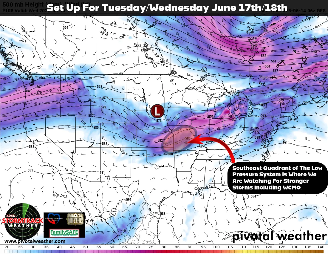
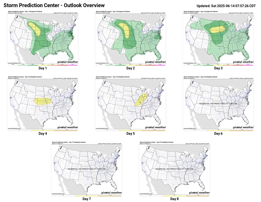
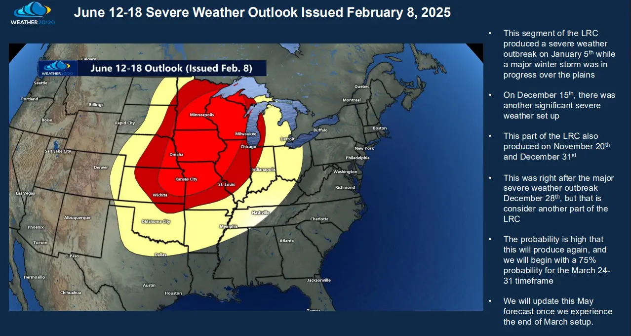
As you can see, we have fairly strong Low Pressure system centered in northeast Nebraska on Tuesday. Looking here at the 500mb map (18k feet above our heads), the circled area is in the southeast quadrant of the storm system, which provides the best lift and upper level wind maximum to help get storms to fire. Of course more ingredients are needed to form thunderstorms including wind shear and instability, but they seem to be in play as well. Keep in mind as well that we are 96 hours from this map and the storm system has not even formed yet, so many things can change. What made me constantly keep looking for a storm system to affect us next week? June 12th through the 18th has been on my LRC calendar for over 7 months! Yes, 7 months! The Weather 20/20 incredible long range forecasting tool, the LRC Model, has been nearly 95% accurate on every storm system to affect our area this year including the January 6th snow storm, the Valentines Day week winter storm system, our first tornado warnings for WCMO in March, our tornado outbreak in Henry, St Clair and Benton counties on May 19th and more. Take a look at the Severe Weather Report issued to our subscribers back on Feb 8th of this year:
This is why the LRC is such an innovative, mind blowing modeling theory that I have been such a proponent of for over 25 years. If anyone would like to learn more about Weather 20/20 and the LRC, please feel free to reach out to me. They offer so many products at so many levels. The Global Predictor is an inexpensive app for your phone or desktop computer that has a 6 month forecast for anywhere around the world. The Global Dashboard goes more in depth and is a must for those in agriculture from a farmer to a rancher. This has rainfall predictions, temperatures, cloud cover, wind projections, humidity levels and so much more for YOUR location for the year. You can check out our website at https://www.weather2020.com/partner/subbys-weather-talk for more information on the dashboard. I also have codes to save you money on any products they offer. I will leave you with the Storm Prediction Center’s severe threat assessment for next 8 days. They added days 4 and 5 slight risk for our area this morning. Have a fantastic weekend! Subby