


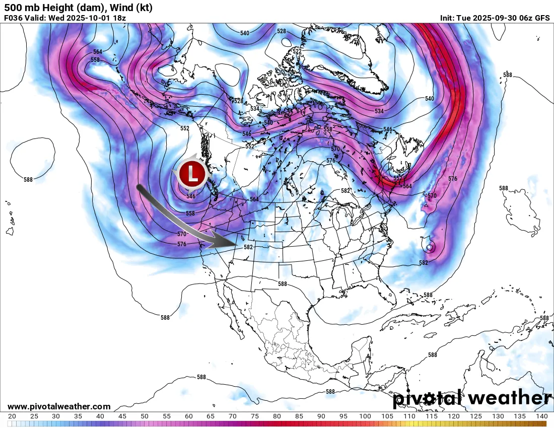
Good morning everyone! Those that have followed the LRC and myself over the last few years know that coming up in October is a very exciting time. A new LRC pattern is beginning to form as each year is unique with different cycle lengths and patterns. The models are showing a brand new feature below for this weekend as a deep trough ejects from the Pacific Northwest and invades the western half of the USA. It could become cut off from the main jet stream but regardless, this is brand new. This means the pattern of the 2025 LRC is beginning to break down and new features are happening:
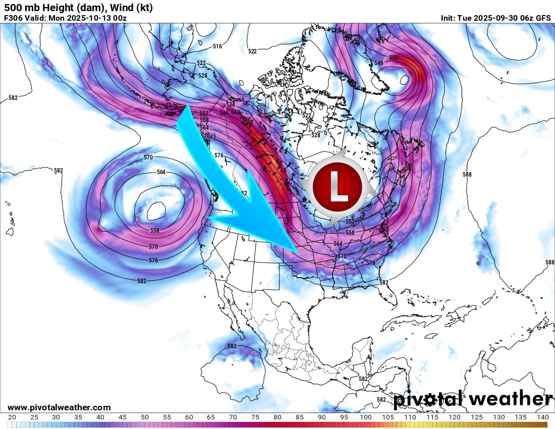
Next we have the models picking up on a deep trough coming from Canada around the middle of the month that could send chilly air down into the Midwest including WCMO. This would be great weather for hay rides, pumpkin patches, and other fall events!
So all in all, we are beginning to see the changes that happen each year when the LRC model begins to evolve into a new cycle. Each year is unique with a different number of days in between the cycles. Figuring out the number of days in between cycles and we can have accurate, long range forecasts for the next 10 months. This last year, the big severe events in the Midwest were nearly 95% accurate! Will this be a more active winter here in West Central Missouri???? Will we have an active severe weather season???? I cant wait until the new LRC sets up to find those answers! We typically have a pretty good handle on the characteristics of the new LRC by around December 7-11th and we will be sharing the Winter Forecast as well as the Severe Weather Forecast for the spring. Have a great day everyone!!! Subby

