Clinton emergency crews continue to assess damage after a tornado moved through the city Wednesday evening, while forecasters warn another round of potentially severe weather could impact the region Friday.
According to the Clinton Fire Department, the storm—confirmed by trained weather spotters—touched down around 6:15 p.m., entering the southwestern part of Clinton near South Second Street by the Missouri Department of Conservation office.
The storm tracked northeast across the city, damaging several trees and causing minor to moderate damage to multiple homes.
Officials say earlier reports of leaking fuel tanks at Champion Brands are false. However, two above-ground diesel storage tanks at a separate warehouse on North Fifth Street were blown over. Both tanks were empty.
The storm also impacted local schools. Henry Elementary and Clinton Intermediate were in the path and sustained minor to moderate roof damage. As a result, Clinton Schools canceled classes for Thursday, April 16.
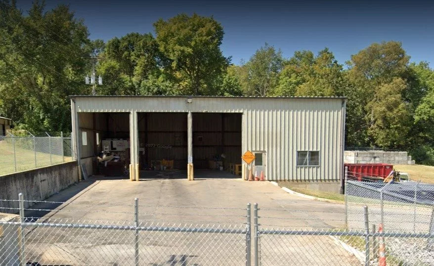
No injuries have been reported within the Clinton city limits. However, several homes were damaged by falling tree limbs, and one structure—a storage building behind American Building Products on South Second Street—was completely destroyed. Multiple power poles were also snapped at their bases in that area.
Damage assessments remain ongoing.
Another Round of Severe Weather Possible Friday
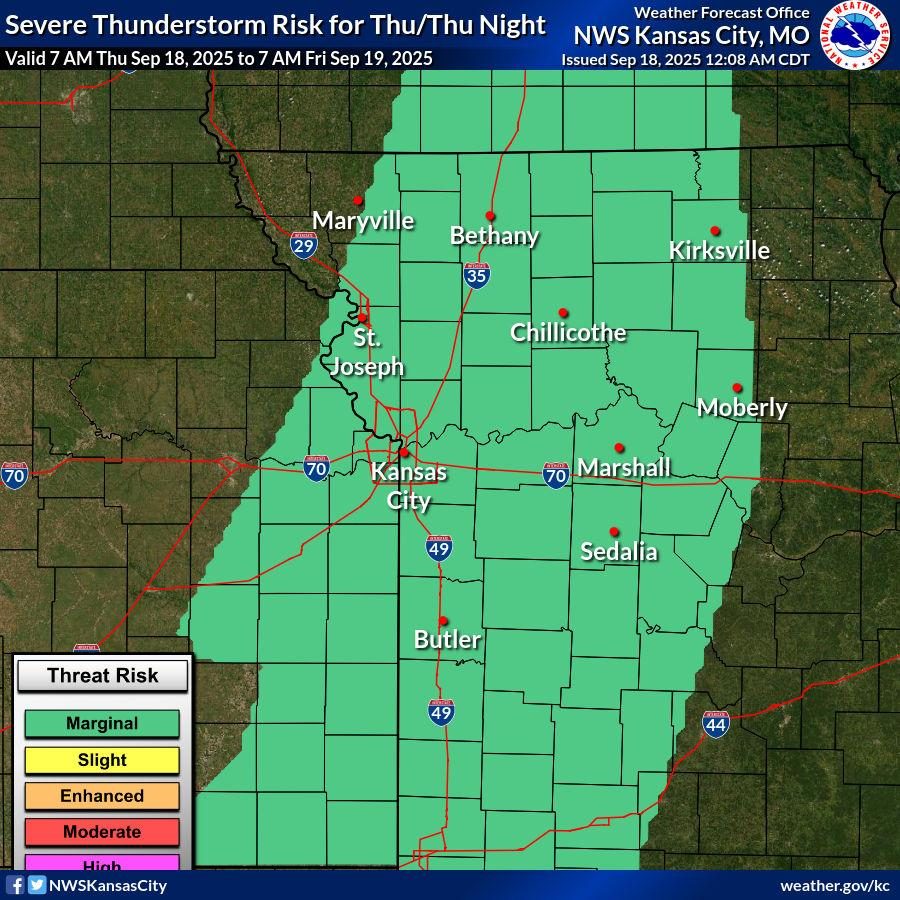
Meanwhile, the National Weather Service in Pleasant Hill is warning of another significant severe weather threat Friday afternoon into the evening, describing it as one of the greatest severe weather potentials in recent days.


Forecasters have placed much of west-central Missouri—including the Clinton area—under an Enhanced Risk (Level 3 out of 5) for severe storms.
The National Weather Service says:
- Storm timing is expected to be similar to Wednesday, developing in the early to mid-afternoon and continuing into the evening
- All hazards are possible, including:
- Large hail (especially with early storms)
- Damaging winds
- A few tornadoes, both with isolated storms and within storm lines
In addition to severe weather, minor flooding and localized flash flooding remain possible due to already saturated ground from recent rainfall. Areas that experience repeated storms could see higher water issues.
Preparedness Urged
With cleanup efforts still underway in Clinton, emergency officials urge residents to remain weather-aware heading into Friday, have multiple ways to receive warnings, and be prepared to take action quickly if severe weather develops.
Further updates will be provided as additional information becomes available.