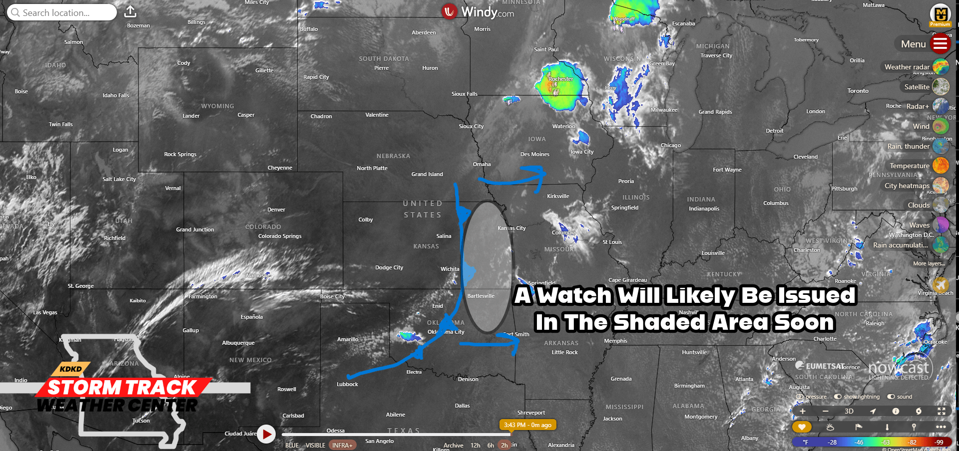
Good afternoon everyone!! The cold front has now made it into Eastern Kansas and already seeing some cumulus building along the front. Out ahead of this front a Severe Thunderstorm Watch will likely be issued from the Storm Prediction Center. We will have to see the progression of any thunderstorms that develop in this area. Any storms that make it into WCMO this evening will have a chance to produce strong straight line winds and large hail. Most likely time frame would be from 7-8pm. There are a few cells out there now in Bates County but those are too far from the front to expect any severe weather with those. I am in the Weather Center all evening and will continue to monitor and update as needed. Subby