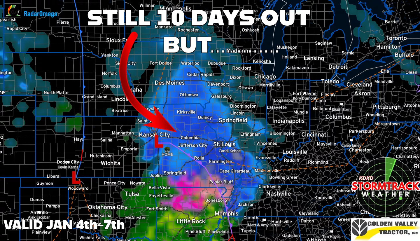
Hey everyone! I hope everyone had a great Christmas and as we head into New Year’s week wanted to update you on a blog we had early last week on the potential to see a winter storm the first week of the new year. There has not been much change as the data still suggests an Arctic Blast and a potential storm system to move across the Midwest, giving WCMO a shot to see some snowfall. The placement of the LOW is crucial for forecasting the area of snowfall but so far, it has not swayed from original forecasted position, leaving us still in the area to receive some wintery precipitation. We are still a few days out so dont catch modelitus, but the map below shows radar interpretation of the data valid for Jan 4th through the 7th;
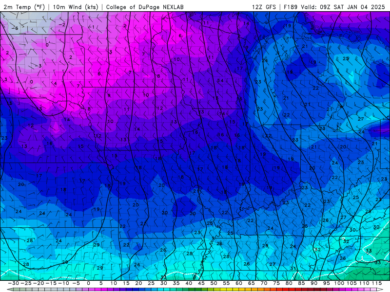
The Arctic air is slated to come down from the North Pole around January 4th (picture below), so the timing looks to be there as we will have cold air in place and moisture being pumped in from the Gulf of Mexico. Things will definitely change in the next week but I will be keeping a close eye on this and see if we can’t extend the Christmas break for the teachers out there…….Subby