


Good morning everyone. Just a reminder we will be having a live stream tonight (Thursday) at 6pm available to watch on 95.3KDKD Facebook Page, Subby’s WCMO Advisory Facebook Page, YouTube @subbysweathertalk and also on the Radford Media Group App for your phones. I will be utilizing all our social media outlets to help get word out to those in WCMO. Over the last 3 or 4 days, my biggest concern has been for the potential of ice. The last run of the models this morning show most of our area getting a good dose of freezing rain and sleet. The winds will be strong on Saturday night and Sunday which will add insult to injury to the situation, possibly causing power outages. The sleet and freezing rain will cut back on our snow fall totals a bunch, but it doesn’t take much ice to create havoc on the roadways. Right now, its looking like 2-3 inches of snowfall on average for most of WCMO and up to a tenth of an inch of ice. It will definitely cause issues on the roads, especially rural roadways. Here is a look at 3 models as of 7am this morning starting off with the GFS, then the Canadian, and lastly the European;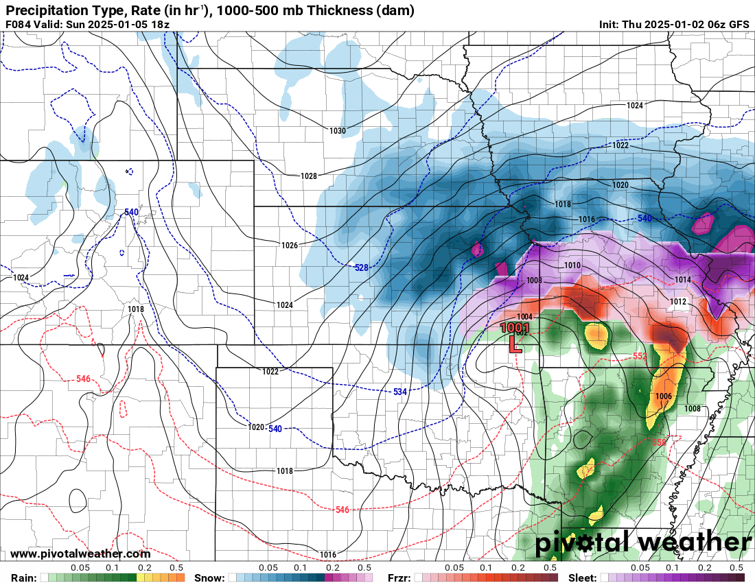
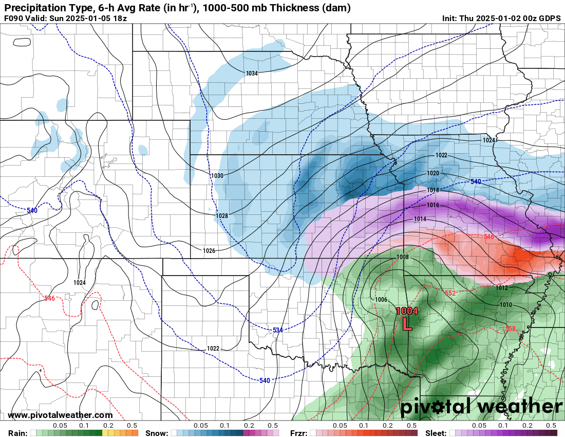
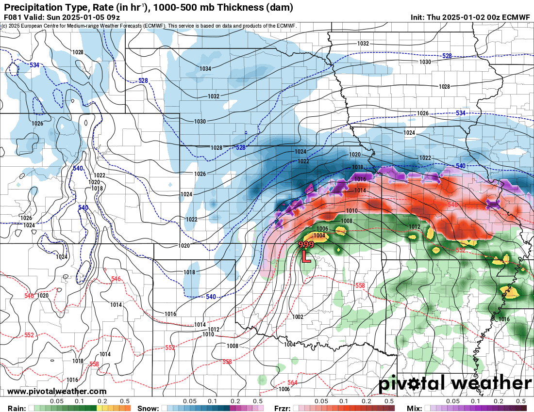
The biggest thing to look for is the location of “L” which is the center of the storm system. A sway of just a few miles can have huge effects on the forecast for a particular area. BUT, all three models do show some troublesome winter weather heading our way. Tune in tonight at 6pm and we will look at the new models and see what they are showing. Have a great day everyone! Subby

