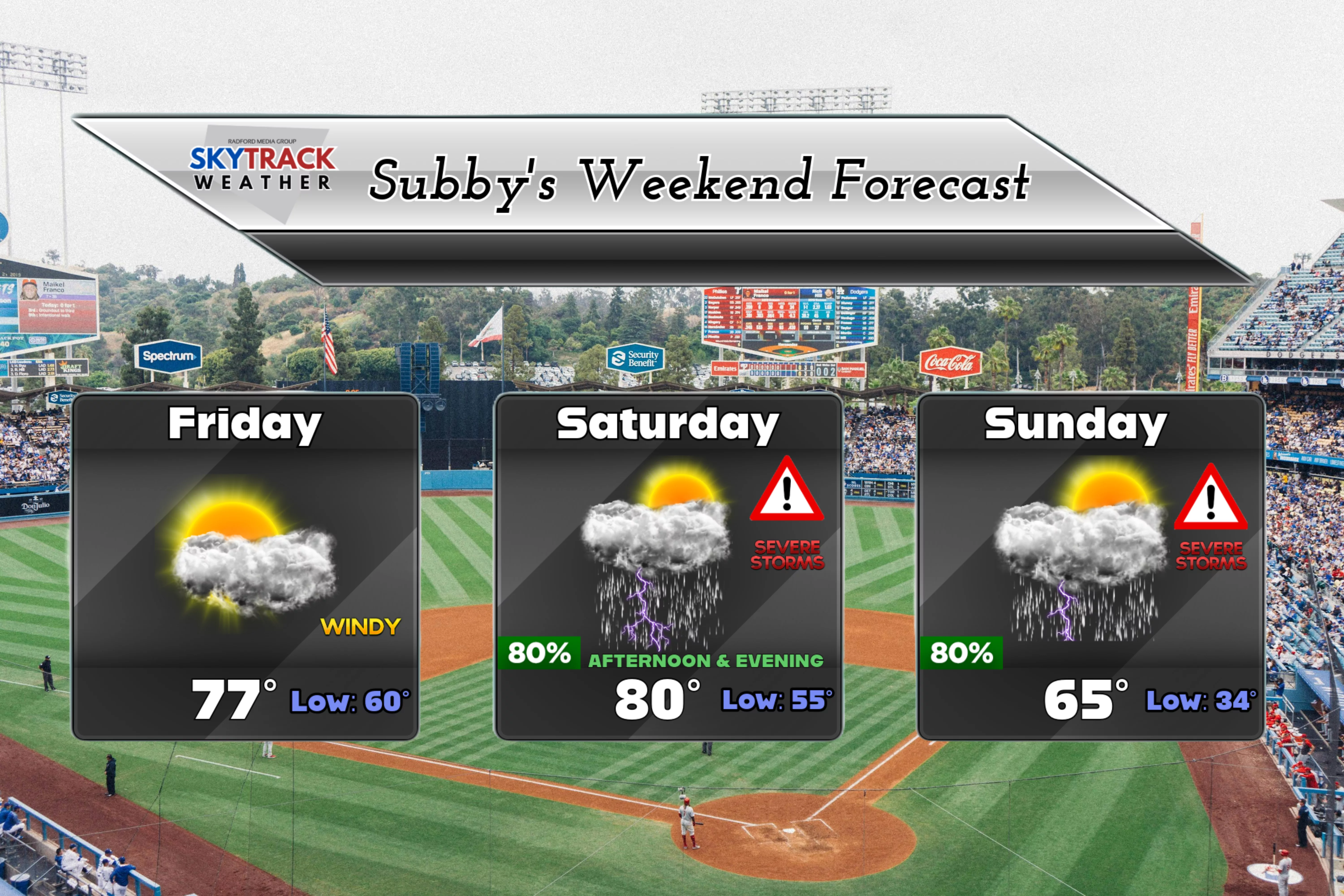

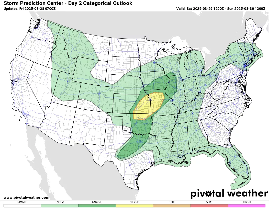
Good Friday morning everyone! These temperatures have been incredible over the last week. The weekend is going to be a mixed bag. Today is looking great outside of the gusty winds to 35mph. Our evening is looking great if you have plans for a night on the town. Saturday is looking great as well, with highs in 70s and we will be seeing plenty of sunshine as well. Then we turn our attention to a cold front that will be bearing down on us on Saturday evening into the early morning hours. This will provide a focus for showers and thunderstorms, in which some may be severe. The Storm Prediction Center has all of WCMO in the slight risk category for seeing severe weather, with hail and strong winds the biggest threat but we could see an isolated tornado (pic 1);
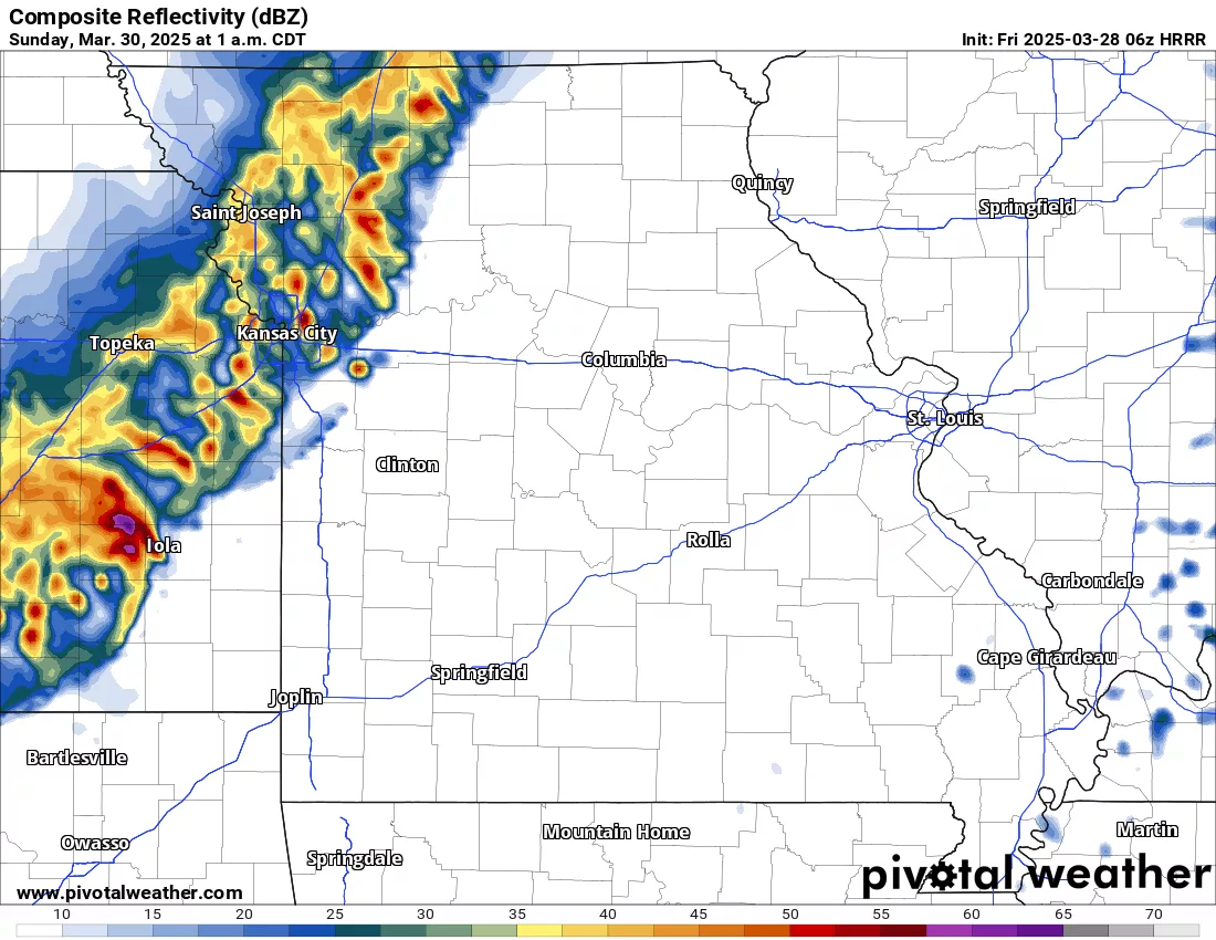
Here is a simulation of what radar could look like around Midnight on Saturday night;
After the passage of the cold front, we will definitely see a drop in temperatures for Sunday with highs in the 60s, likely early in the morning, then dropping as the day goes on. We will still see a chance to see rain and thunderstorms throughout the day on Sunday as well. The lows will drop down into the low to mid 30s for Sunday night, but thankfully the precipitation will be moved on to the east and no threat for any snowfall. I will leave you with the summary of the forecast for the weekend below. Have a fabulous Friday!