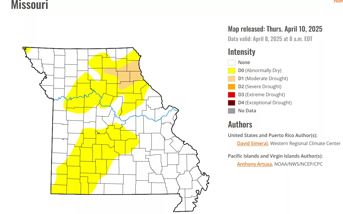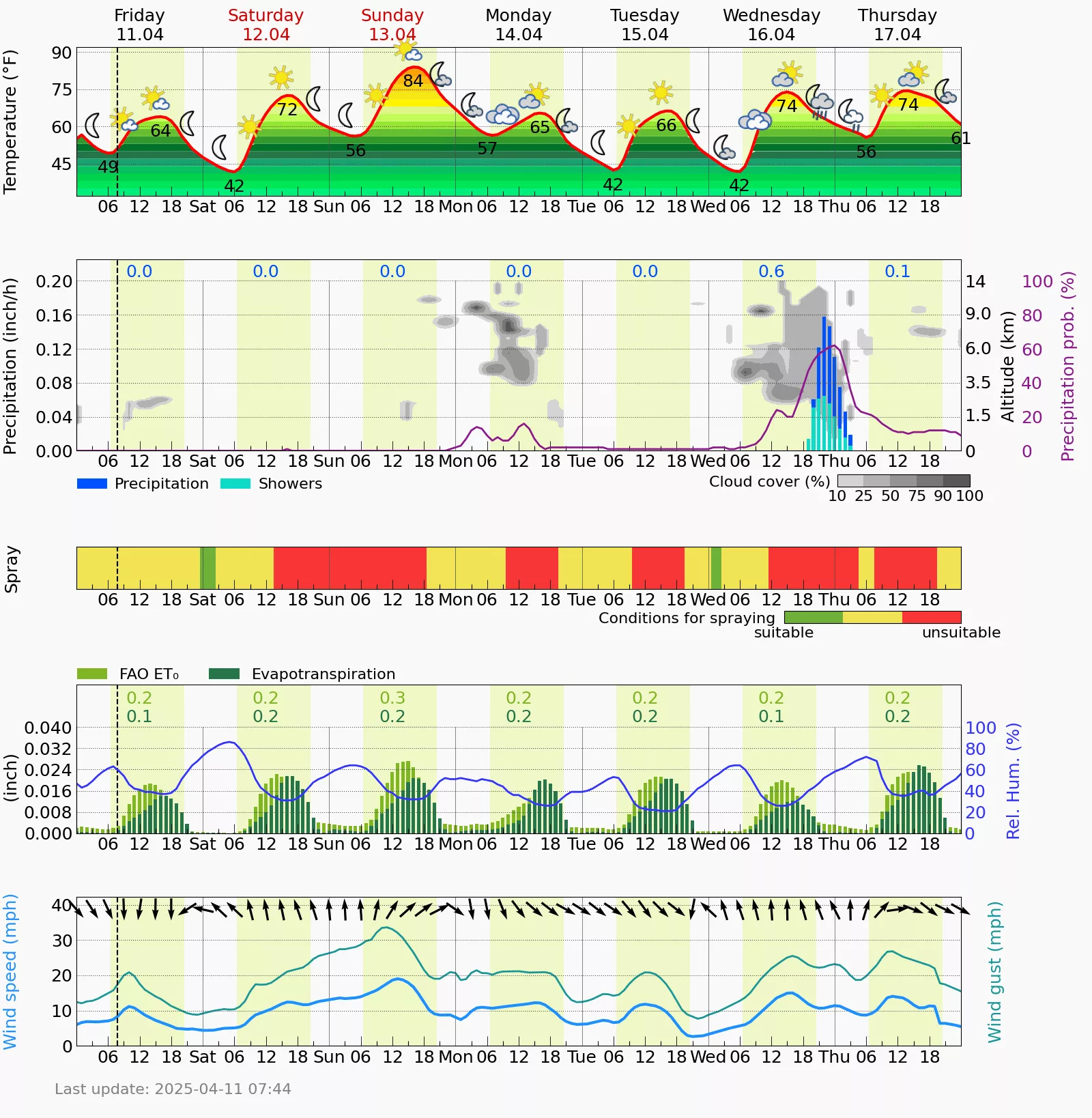

A beautiful weekend in store for us here in West Central Missouri and by the number of tractors and implements I saw yesterday on the roadways, farmers are getting a head start in the fields. Our next chance of rain and thunderstorms is coming in on Wednesday and Thursday next week, as a start of an active stretch of weather through the first few days of May is coming up. The drought index for our area this week is looking great, with very little of West Central Missouri included in the index (pic 1). The winter wheat also is looking like it survived the below freezing temperatures we had last week. The long range forecast per the LRC is hinting that it was the last freeze of the season as well. I have also included our exclusive Farmers Ag Meteogram from our weather center, to give you an idea of the week ahead (pic 2). Have a great weekend everyone! Subby