


Good Tuesday morning everyone! I wanted to take a look a little more long range, especially for those in the ag industry, what we can expect over the next few weeks and months. The LRC has done such a great job so far this year in picking out the key dates of dry and wet episodes, as well as the severe weather outbreaks. The large storm systems that provided snow for us in the winter and severe storms in the spring have been up on my calendar since the day after Thanksgiving!! They have been 100% correct! Just incredible;
So what do we have to look forward to? Last month, I began to suggest that the area farmers keep June 21st through the 4th of July as an active stretch to get out to the fields, as we will likely be going through a multi day dry stretch before a more active period comes in on the 4th/5th of July, bringing the threat of a bit more substantial rains. This was based on the LRC as well and is spot on. Here is a look at the chart for rainfall for the next few days:
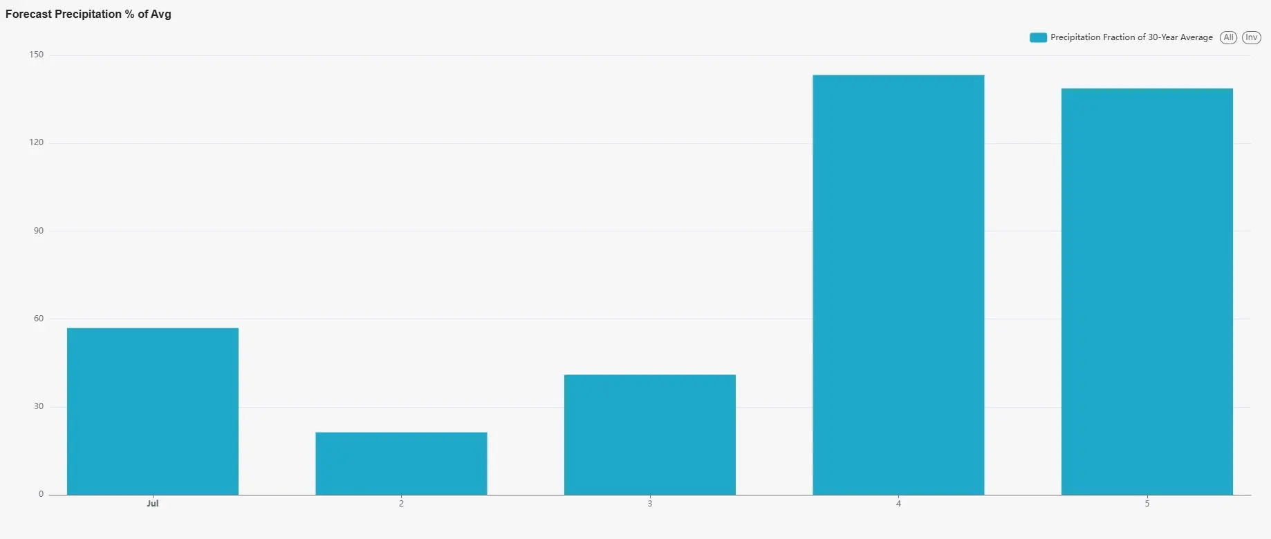
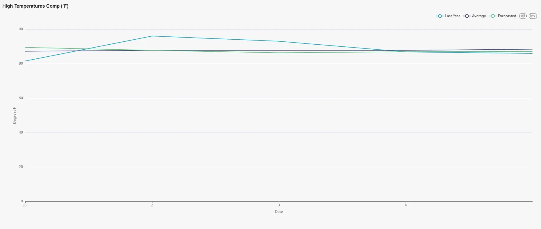
The vertical line is the percent of average over the last 30 years by the week. Anything over 100% is considered to be an abnormally wet period and obviously above average. Notice how the bars really go up on the 4th through the 8th. July average precipitation is not all that impressive to compare to, however, this does show us when to look for a storm system that could affect our area coming into the Midwest. Our temperatures will fall back to near normal to just below beginning after the weekend, just in time for the Holiday festivities and below what we had last year;
Looking out even further into the end of summer in August, we do see a couple dry stretches as any other year, however, we do see periods of much needed rainfall. Remember, anything over 100 percent on the vertical line is above our 30 year average, with 7.3″ as projected rainfall during this period;
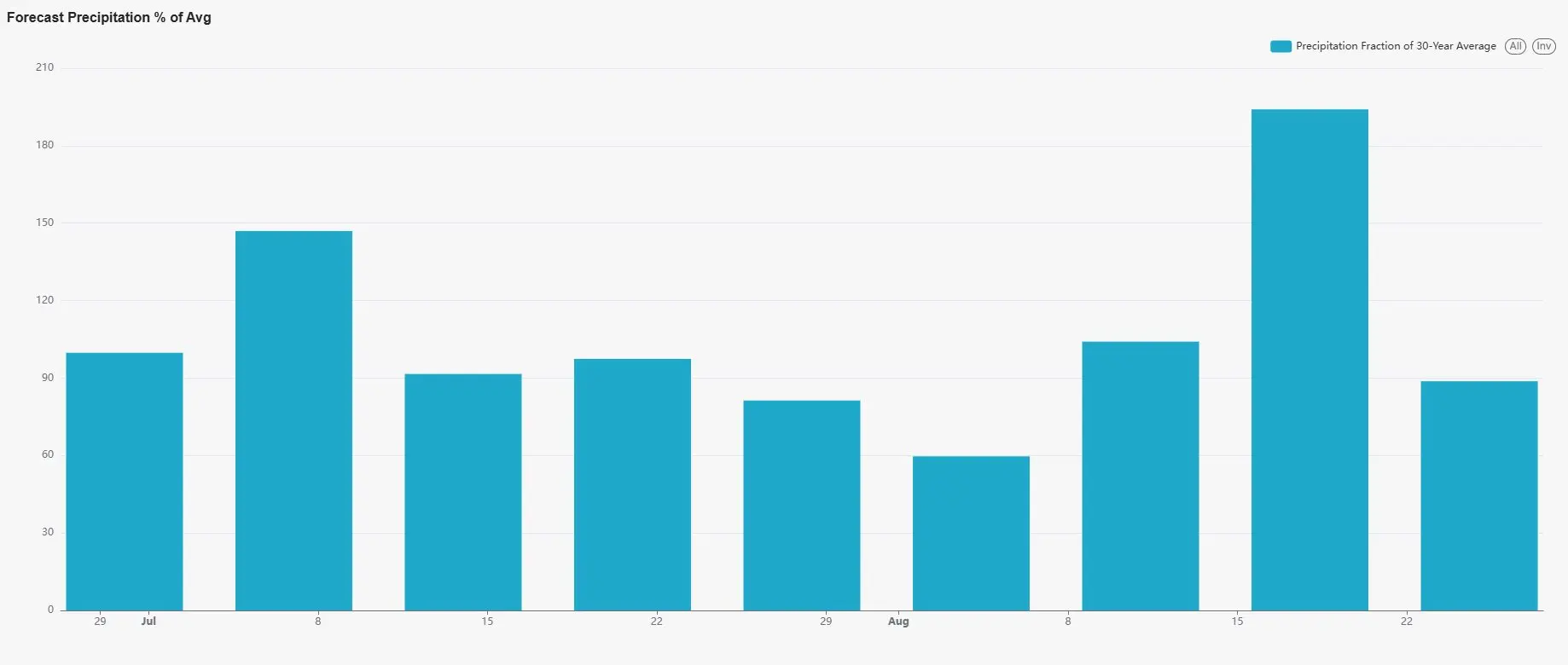
I am not seeing any abnormal drought conditions for the summer which is great news for the farmer. That system affecting us around the 16th of August is likely a tropical storm from the Gulf of America that the LRC and Weather 20/20 projected to hit Texas and Louisiana in their Tropical Report published last month. This may or may not effect the beginning of some harvest action in the fields. Temperatures look moderate at well:
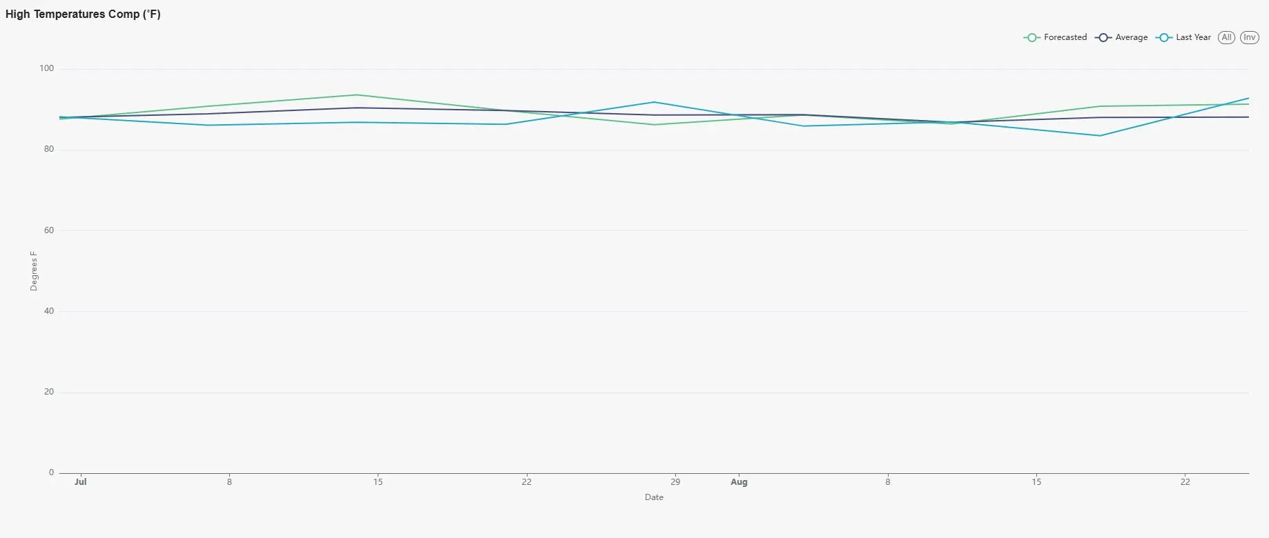
A spike in temps in the middle of July and again in the middle of August, but they don’t seem to last long before we return back to normal to slightly below normal. So all in all, a fantastic looking ag report for the summer and for the gardens. The overall projection of rainfall is nearly 98 percent of a 30 year average through the end of August, which we have not seen in a few years. We still need to be aware that if a tropical system should form, no matter how weak or strong, it could effect our weather pattern for the short term. I will be updating if it should. Have a great rest of the day! Subby

