


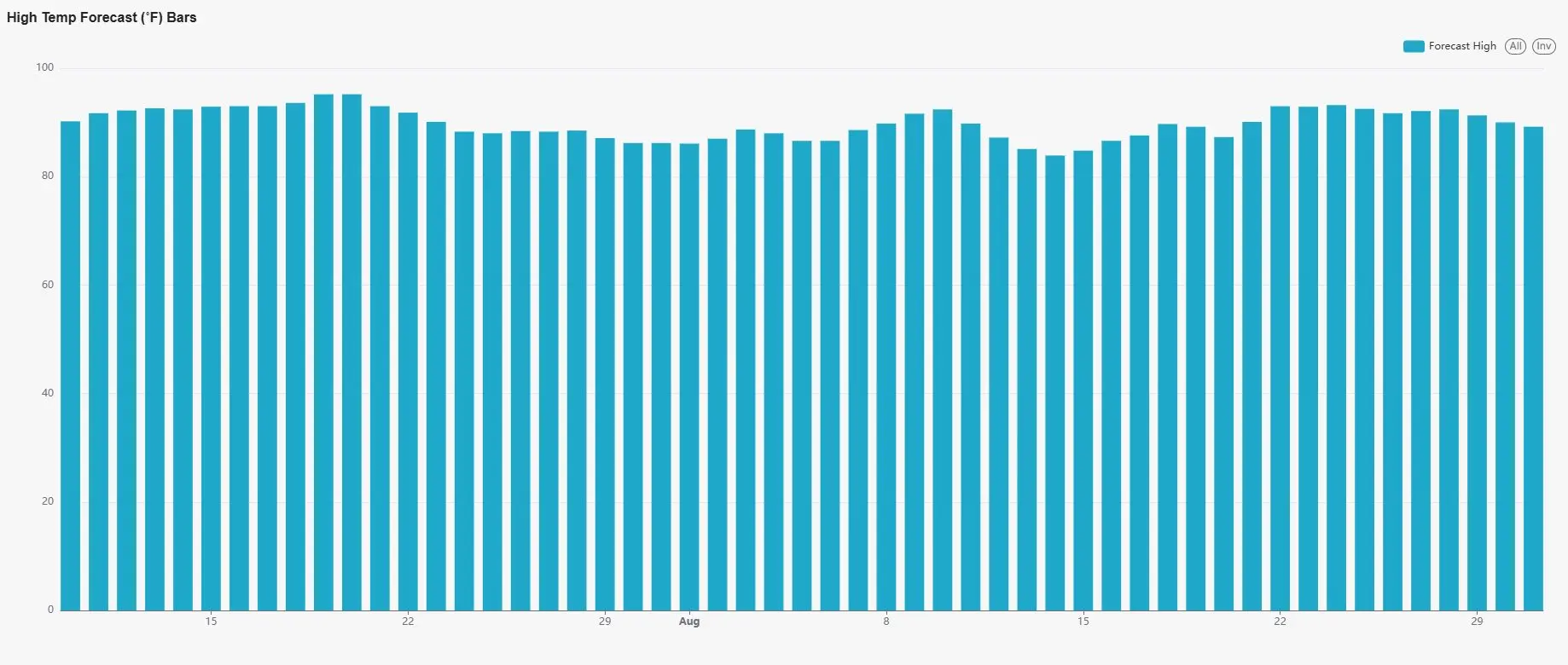
Good morning everyone! I thought we would take minute this morning and check out the long range forecast utilizing the LRC Dashboard. The LRC has proven yet again to be an industry leading package that is revolutionizing long range forecasting across the globe. Every major weather set up for WCMO including winter and severe weather has materialized 100% since Thanksgiving. Now, the LRC is not a crystal ball and is not 100% accurate on EVERY forecast, but it has been nearly spot on. I was nearly the only one in the Midwest to go against the popular opinion of a very dry forecast for the spring and into June and July. Using the LRC, it showed our area here in WCMO to be nearing 100 percent of moisture based on our 30 year average. We have not seen that in years! But I held my ground and sent out portfolios to a few area farmers in February and it raised a few eyebrows. BUT, it has been ever so accurate on the wet weeks, dry weeks and on total rainfall! Let’s take a look at what we are expecting from now through August. As far as temperatures go, we are looking to continue our pattern that we have been having; a few days below average, then a couple days in the low to mid 90s. It is not showing any extended heat waves in WCMO, nor showing a 100 degree day!
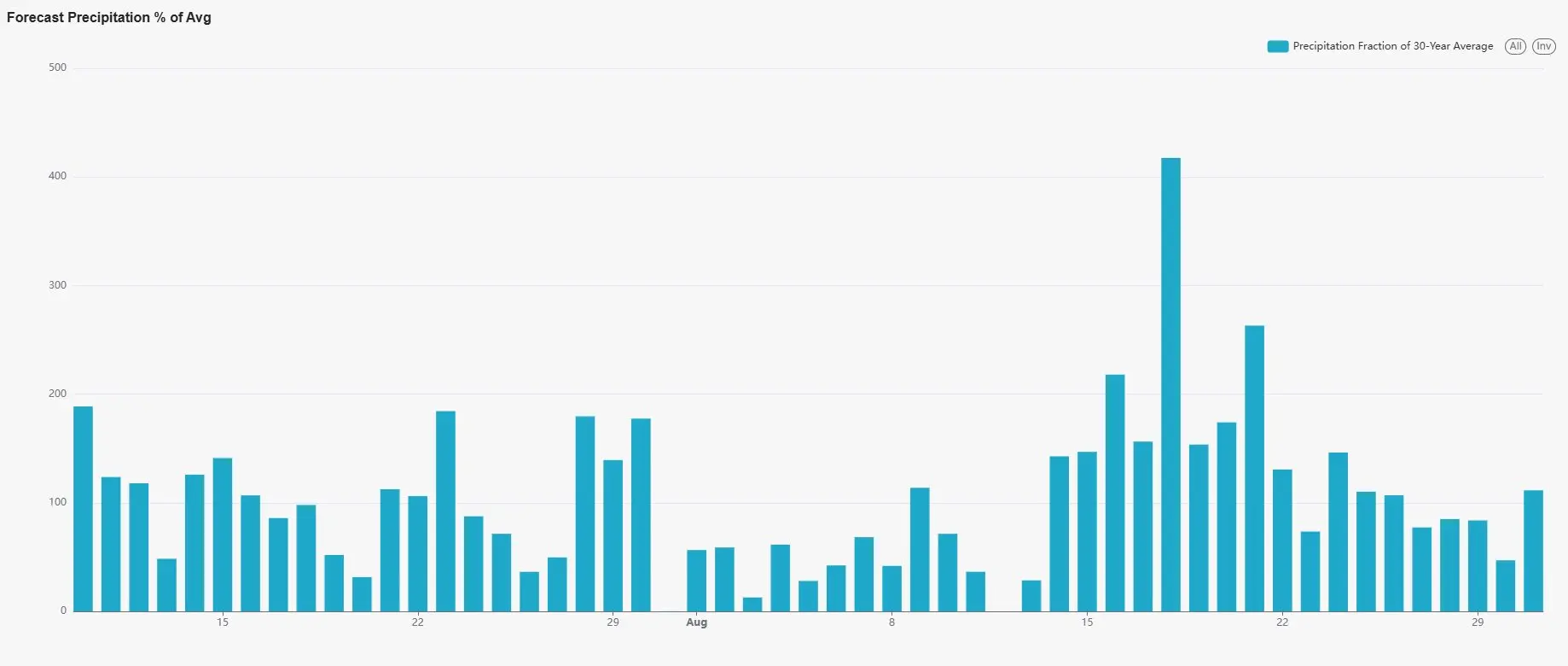
Looking out on our precipitation for West Central Missouri, we continue to see periods of rainfall through out rest of summer. This is such great news for area farmers. They have been needing a season like this for such a long time. As you take a look at the daily graph below, anything above 100% on the vertical line is showing above average precipitation. Notice how the rest of July is showing several days above average for precipitation, and this is due to the pattern we have been in with numerous isolated thunderstorm chances nearly every afternoon. We do catch a dry period from around the 1st of August through the 14th. This will be a great opportunity to be in the fields and getting another cut of hay down and maybe even grabbing some early planted corn. After that, our more active period of the LRC returns with around 10 days of above average rainfall:
As far as our total rainfall for this period through the end of August, all of WCMO is poised to received nearly 100 percent of the 30 year average for our area (approx 6.5″). Again, this is such promising news for the ag industry. 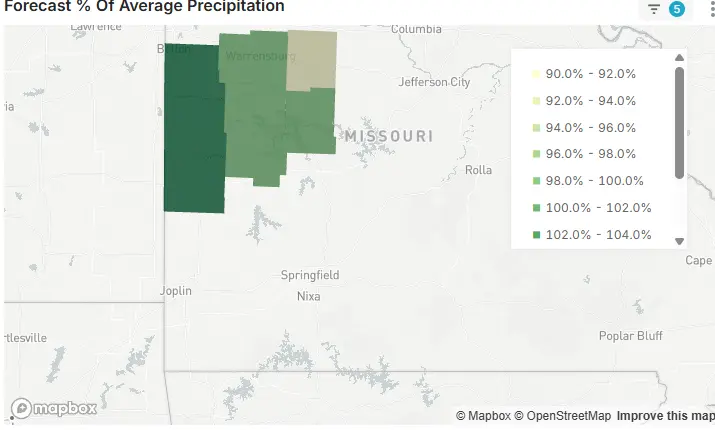
So in summary, we are looking great here in our area for precipitation as well as keeping the temperatures in check with very few anomalies from our average. If anyone is interested in utilizing the LRC Dashboard for your farm or business, you can go to https://www.weather2020.com/partner/subbys-weather-talk where I have some great discounts for you to use. If anyone is interested in the Global Predictor app for your phone or computer, Tropical Outlook, Winter Outlook or any other of the products that they offer, get with me for a special code to save you some $$$$. Have a great rest of the day everyone! Subby

