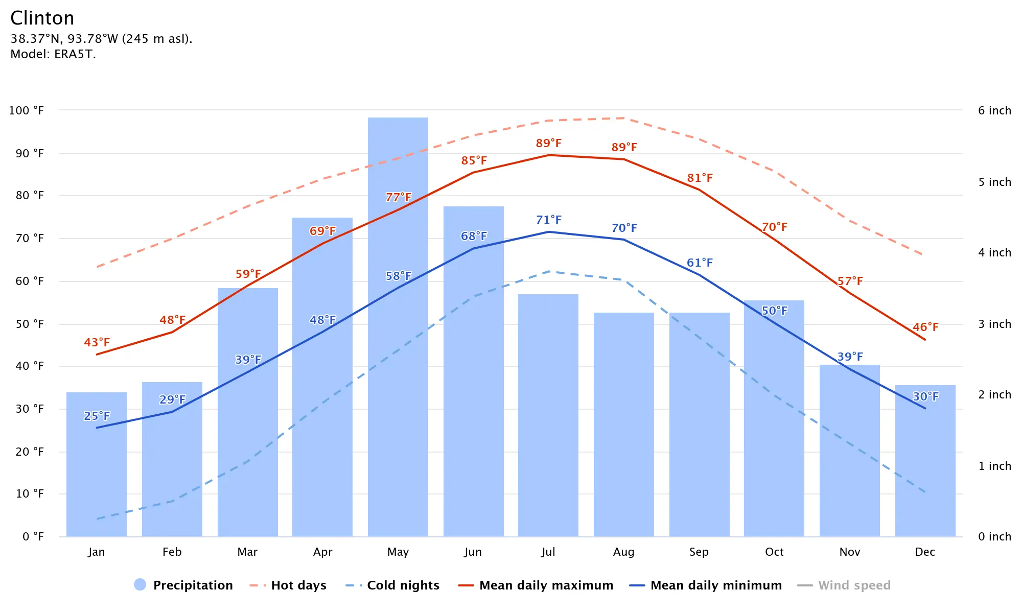
What an incredible weekend of nice weather we had! I saw a ton of balers and hay equipment operating in the pastures as well, as the farmers taking advantage of the cool and dry weather this week. This should last through the middle of the month, outside of a couple chances to see an isolated shower or 2 through this time period. As of the latest drought monitor the entire state is now considered 100 percent drought free. Significant improvement was noted for just about all the states in the Midwest this week. Pastures in the state continue to be some of the highest rated in the nation and much better than those in neighboring states. Hay movement has been slow, prices are steady to weak, supplies are heavy, and demand is light. This has been a rather unique summer, more so than I think I can remember. Now we are seeing signs that there is too much harvest going on out there and that is driving the price down, even though our weather has been spectacular from an agricultural sense. As I mentioned above, our second half of August looks to get more active according to the LRC. We are also expecting the temperatures to fall below average as well in West Central Missouri in the the later half of month. The LRC nailed down the cooler start of August and dry conditions over 6 months ago! In case your wondering, here is a comparison chart with our average temperatures and rainfall for here in our area month to month;
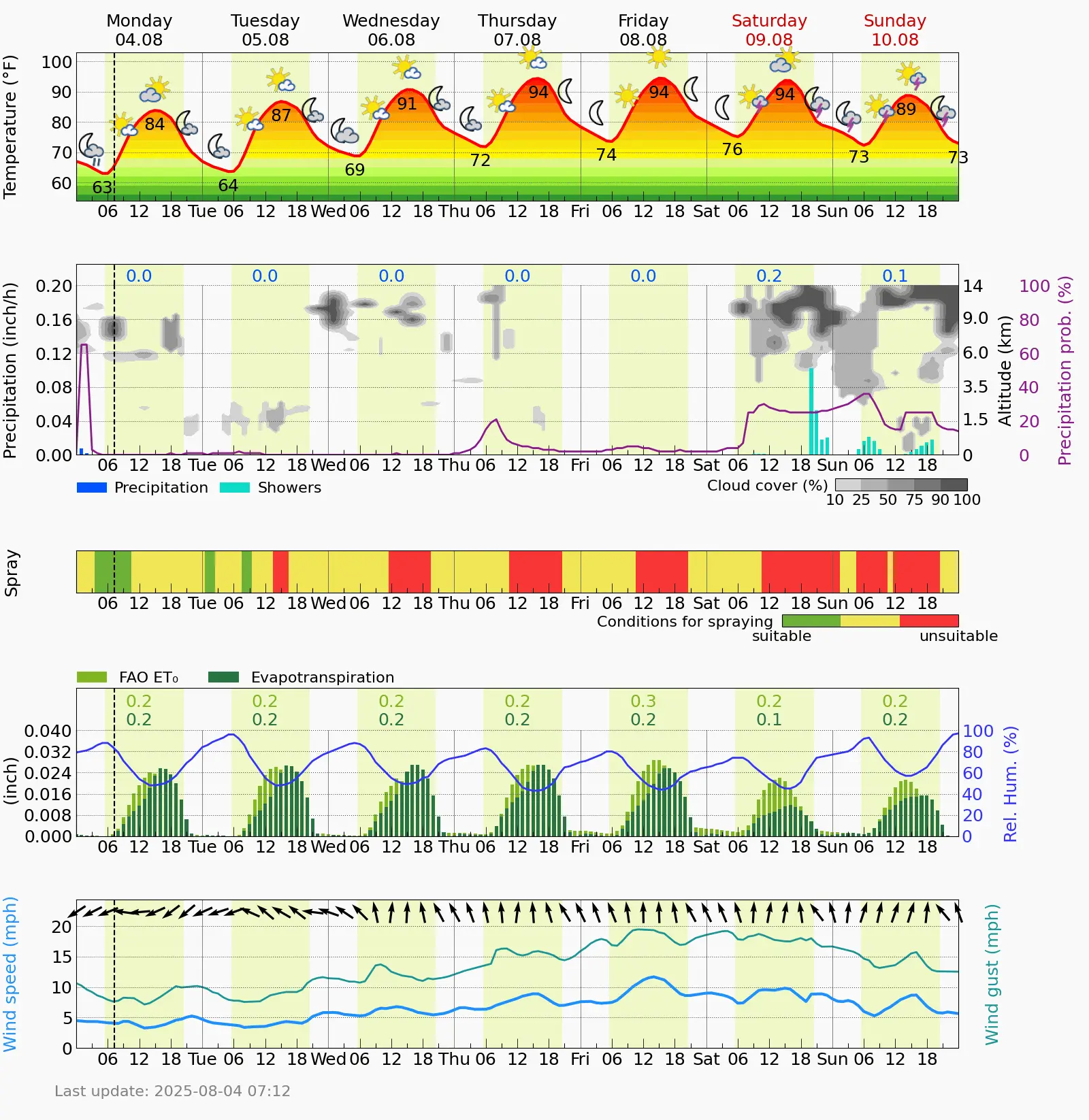
Until we begin our more active stretch, we will heat back up over the next few days through the weekend, with temperatures reaching back into the lower 90s. By next week, we will begin to notice an overall shift in lower temperatures and more chances of rain entering the forecast. I will leave you with our exclusive Ag Meteogram, showcasing some weather highlights of the week for the fields. Have a great day everyone! Subby