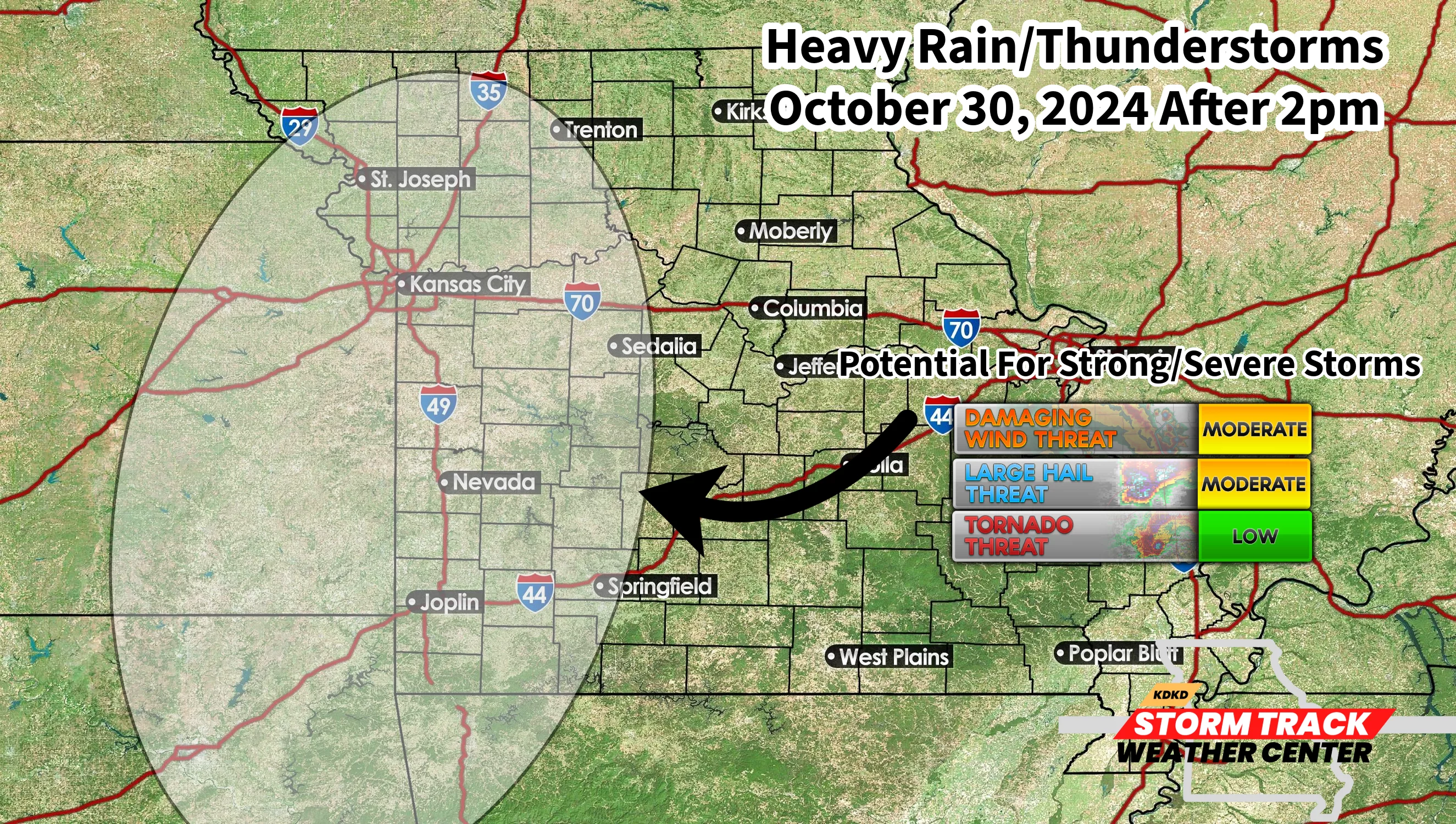
Good morning everyone. As we talked about couple weeks ago, big changes are happening way up above our heads as our pattern and the LRC are really transitioning away from the dry conditions we have had over the last 45 days. We have 2 big storm systems that will be affecting West Central Missouri over the next 10 days in which the first one is already beginning to be felt as winds gust to over 30 miles per hour today. On Tuesday we will see non-thunderstorm winds approach 50-55 mph ahead of this powerhouse storm! Current thinking right now is that thunderstorms will be possible after 2pm on Wednesday and continue to push across WCMO with the main threats being strong straight line winds and a few reports of large hail. The tornado potential is low, but definitely not zero. I will be continuing to watch this very closely over the next 36-48 hours and will be giving updates frequently on our storm chances. Just a 50 mile swing of the Low Pressure System will shift the biggest severe threat. The good news is that the rainfall is nearly certain, adding .75″ to 1.5″ of rainfall to our rain gauges. We will talk more about the potential impacts of the second system due to arrive around Election Day once we get past this round on Wednesday. Here is current hazards for Wednesday;