


Good morning everyone! We start a nice warm-up on Wednesday through Friday with temperatures approaching the 50s by Friday afternoon! On Saturday evening, the winds will be shifting to come out of the Northwest, as an approaching Arctic Blast will be ushering into the Central Plains through mid to late next week. This will bring temperatures down into the single digits and wind chills into the negative range (picture below shows departure from average).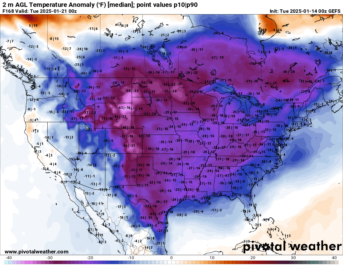
The models are all over the place in terms of precipitation during this period from Jan 18th thru Jan 24th. When this happens, I like to look at the ensembles, which is an average of several data groups. This particular ensemble below is the GEFS which is comprised of over 31 different models and shows the average snowfall through this period. As you can see, not much snow for the Central US;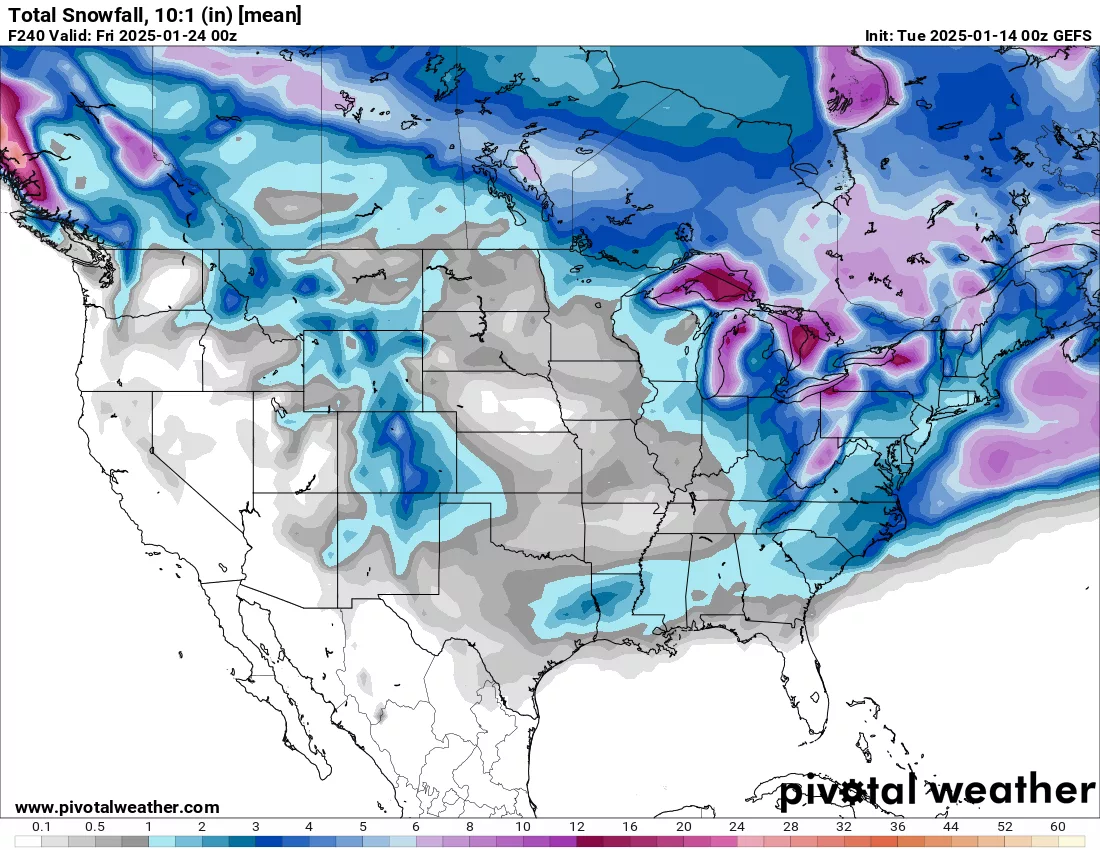
I do see a couple “ripples” in the upper atmosphere using the 500mb map that could mean a couple of disturbances that might bring us some isolated snow showers but not much otherwise. We have to remember that we are nearly a week out, so things WILL change. I will be watching this closely for any changes and update via our social media platforms. Have a great day everyone! Subby

