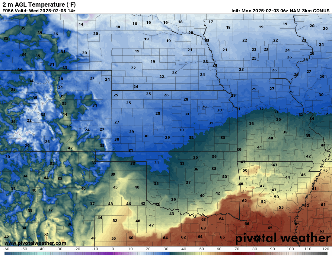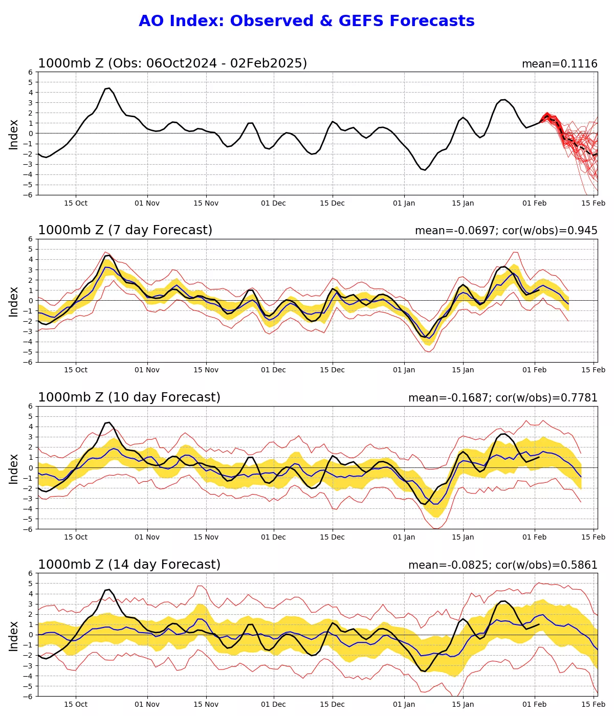

Happy Monday everyone! Yes, just as the title suggest, winter is not done with us yet. Matter of fact, the temperatures for Wednesday morning in parts of Cass, Johnson and Pettis counties may be cold enough for some freezing drizzle (pic 1)! Luckily we will still warm up Wednesday afternoon if there are any travel issues, they won’t last long. Taking a look ahead, I glanced at the AO (Arctic Oscillation) chart and right on cue with the LRC, it is signaling the return of cold arctic air for the last half of February. Remember, when looking at the AO chart (pic 2), when it dips negative, that means that the air pressure is weak at the North Pole and the jet stream can tap into that cold air and drag it into the USA. We have a storm system set to arrive around Valentine’s Day that will likely create a winter storm somewhere in the northern half of the USA and severe storms in the South. As we are most of the time, WCMO will be in the battle zone between the 2 air masses. Until then, we are still in the warmer/active part of the LRC cycle and we have rain possible middle of the week. The temperatures will be near average to slightly above in the mid to upper 40s and into the 50s. Have a great week everyone! Subby