


Good morning everyone! Wow, what a powerhouse storm system that tracked right over West Central Missouri this week! 1.75″ of rainfall, pea size hail,52mph wind gusts, and a dusting of snowfall all in a matter of 24 hours here in Henry County. So what is next? The LRC (Lezak Re-occurring Cycle) pin pointed this last system back 120 days ago. We do have a couple small systems to round out the month with, but our next BIG system looks to arrive around April 14th – 18th. The first of the smaller systems according to the LRC shows up around March 12th-16th. You can see that system just now entering into some of the model output below:
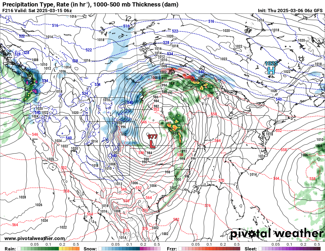
I will be watching this system for any threat of severe weather. Notice how the model is showing a 977mb Low Pressure system. Our last storm system was a 980mb to give you some comparison. So this one needs to be watched closely. Our next system after this one will affect us around March 20th thru March 22nd. A dry slot for the farmers still looks on track for April 3rd through the April 10th. This will have to be watched closely as very few dry days ahead of that period. That’s all for now, have a great day everyone! Subby

