
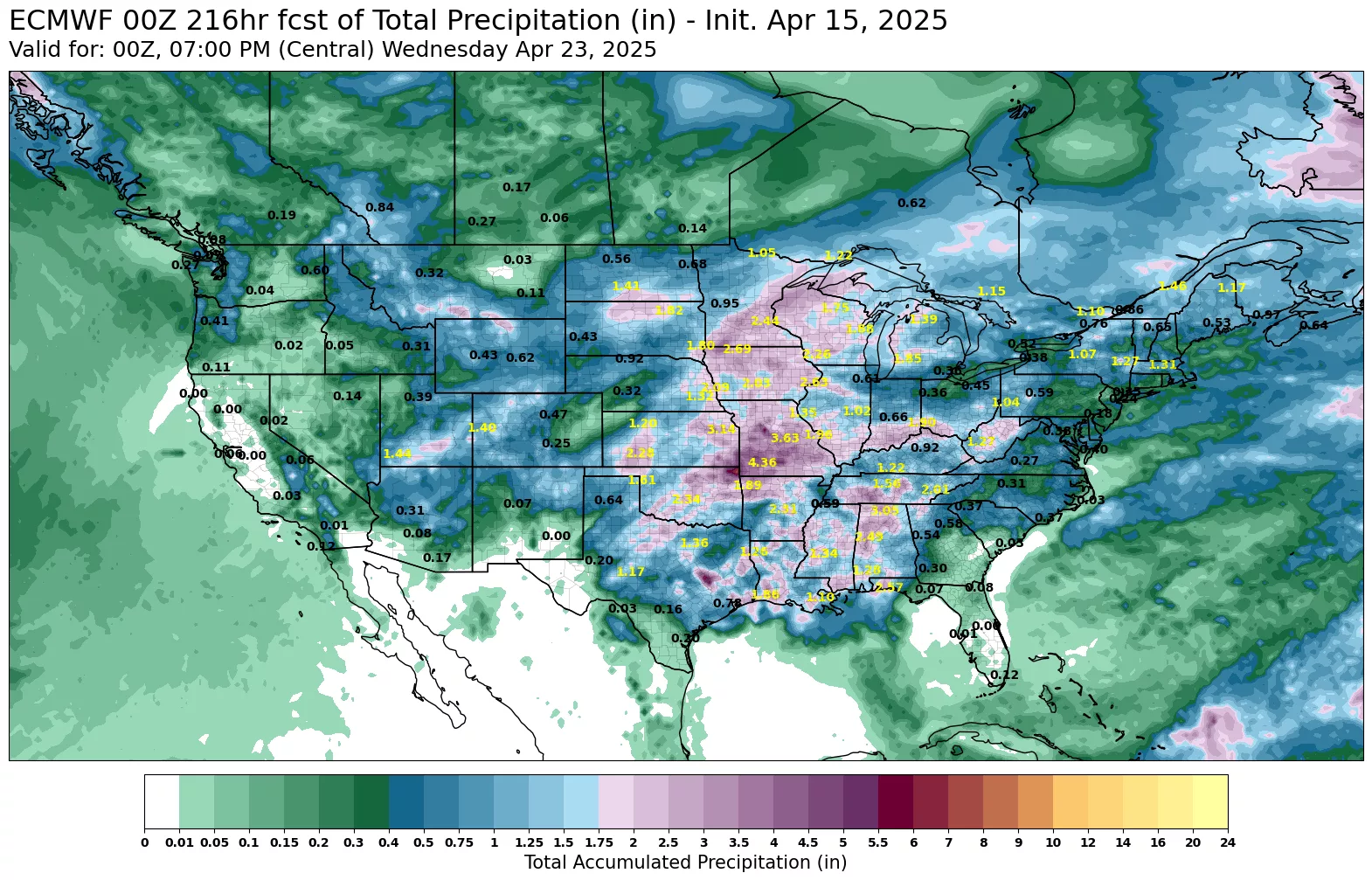
Good morning everyone. As we have been mentioning over the last couple weeks, we have the active part of the LRC working its way into our area beginning on Wednesday. We look to have several rounds of rain and thunderstorms through the middle of next week. Along with the rainfall, there is a chance to see some severe weather with strong winds, hail, and the potential to see a couple tornadoes, mainly on Friday and possibly on Easter Sunday. The data is showing the potential of 2″ to 4″ of rainfall here in West Central Missouri through the middle of next week (pic 1);
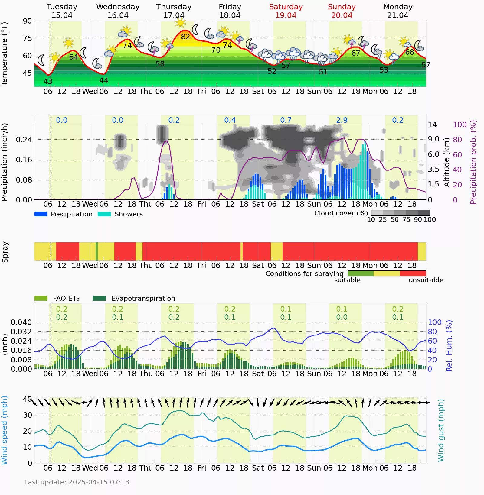
I know many of you have worked over the fields and I saw many pulling planters over ground throughout last weekend. With such a large area of heavy rainfall, we can expect all the rivers and streams to be bank full if not out of their banks by next week, so keep this in mind if you have any bottom ground. Winter wheat is looking exceptional around where I have seen in Bates and Henry Counties, so that is very good news it was not damaged by the frost 10 days ago. I will leave you with our area’s Ag Meteogram from our house model down here at Bomgaar’s Weather Center. Have a great Tuesday everyone!