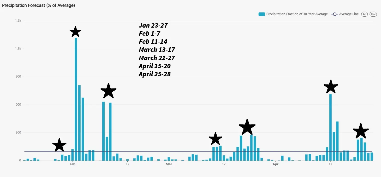

Good morning everyone! A bit slick out on this Saturday morning after some snow showers came through WCMO yesterday evening. With temperatures dropping so fast, black ice is a real threat out there this morning. Be careful on overpasses and bridges. This was a very strong system and associated cold front that moved in but just like many systems so far this winter, it was lacking moisture. We have a bit of an active stretch over the next 10-14 days coming up. A weaker system is set for around the 23rd/24th of this month and a bigger system around Feb 2nd/6th. We will be watching a system the LRC is signaling around Feb 12-15th before we hit our dry stretch once again, similar to what we saw in December. An early start severe weather season could be in the works around the middle of the month of March that has my attention. This system also is similar in nature to one back in 2008 where we had a surprise snow storm that dumped 8″ of snowfall in our area in the middle of March. The LRC has done an incredible job showing when the storm systems will be heading our direction this year so far. The small pieces of the atmospheric puzzle are telling us key elements such as; how much moisture associated with system, how much cold air will be wrapped around the system and other dynamics of the storm. So far, a common issue is the moisture. This is concerning as we head into summer time with the farmers. I included a snapshot of the a graph from the LRC Weather 20/20 Dashboard, showing storm systems for our counties here in West Central Missouri. This can help with future planning. Have a great rest of the weekend! Subby