


Good Sunday morning everyone! We are going to have a few days of just gorgeous weather here in West Central Missouri with highs in the 60s and 70s! Then we enter into an active stretch of weather for the next 5 to 7 days. A system will be passing to our south of on Tuesday, that will bring in some cooler but mild air along with a slight chance of a shower or two. A much bigger system comes in on Friday the 13th and Valentines Day. I am still thinking all liquid form, since the cold air is still being bottled up near the North Pole and the storm system unable to tap into any of it. We could see a quarter to three quarters of an inch of rain with this system. Here is a model sample for February 14th:
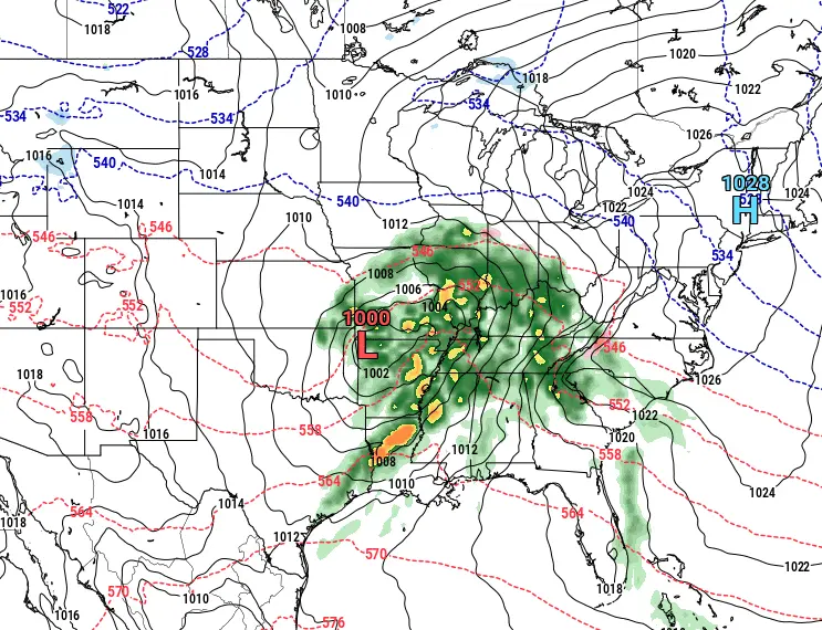
Notice how the 540 blue dashed line is way up in Iowa and the Northern Plains. This is the 32° line and as you can see, looks to stay way north of WCMO. That leaves us in the area for all liquid showers and thundershowers. We have an even stronger system poised to move across around the 17th-21st (Next Tuesday-Friday), and that system is pulling the 540 blue dashed line all way down south into New Mexico as seen below;
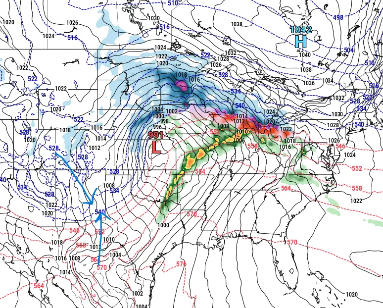
This system we will have to watch closely as we could see some wrap around winter precipitation as colder air filters in behind this system. This will also lead us into a North West flow of air from Canada and will cool us back down to average temperatures for this time of year. So all in all, enjoy the next few days of beautiful weather and lets hope we get this much needed moisture for the fields and not so much the troublesome winter precipitation (unless your a snow lover!). Have a great rest of your weekend. Subby

