


Good morning everyone! Hopefully everyone got to catch the LRC Winter Weather Forecast for WCMO on Tuesday! Very interesting pattern we are going into for the rest of 2024 and into 2025. During this active stretch the LRC is predicting from around Dec 16th through around Jan 6th, a couple of bigger storm systems are likely. The models are now starting to come around picking up some of these upper level hints that the LRC has shown. We have talked about this several times through out the storm seasons but models are an incredibly great tool for forecasters but they can also allow them to catch “modelitus”. We have to remember that models show us what COULD happen, not what WILL happen. They allow us to see trends and possibilities. Our job as forecasters and meteorologist is not to see which models are wrong, but which ones are right. Take a look at this model ensemble from the GEFS. This particular model shows us 20 likely scenarios with the storm system set to make its way into our area around Dec 19th/20th;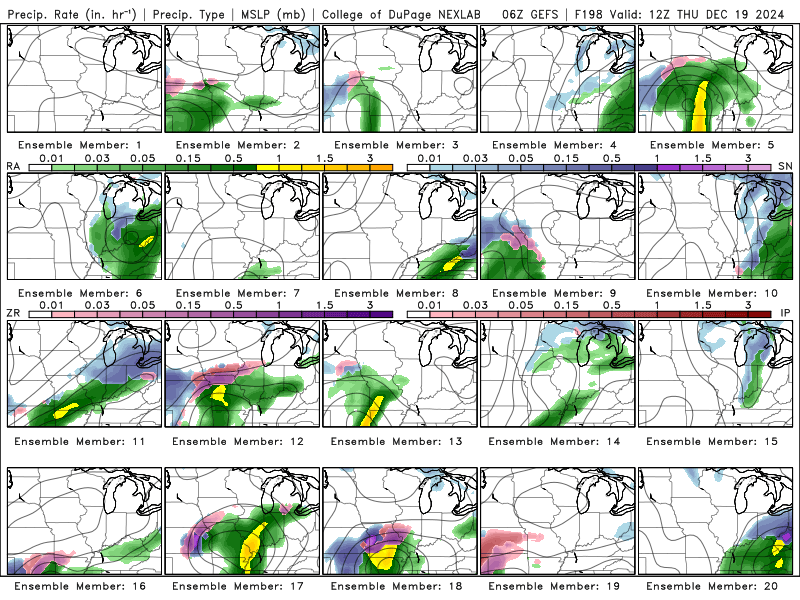
So a quarter of these are showing no precipitation for our area, another quarter are showing heavy rain, another quarter showing big ice storm, and another quarter showing a heavy snow event…HAHAHAHA! So its my job to take a look at all the parameters including temperatures, upper level winds, position of pressure systems, etc. and determine which model is more than likely to happen. Even with simple day to day forecasting, models are all over the place with simple data such as temperatures. I utilize a “in house model” here at the weather center, utilizing my own input injected into data from 13 other models. Take a look below at the temperature models for this weekend. My forecast is in bold black/white while all the other models are shown in different colors. Look how they differ! 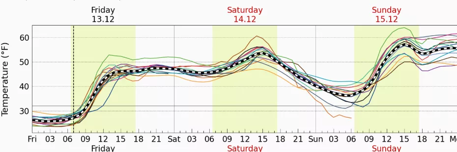
So the take away, is do not fall victim of “modelitus” this winter season. Many social media posts come along from different forecasters/storm chasers/tv stations etc that will take 1 model and run with it, stirring up the audience. Just keep in mind that we have a storm system approaching next week and we will take this one day at a time and issue the best forecast we can with ALL the data and models utilized to keep the information as timely and accurate as possible. Have a great weekend everyone! Subby

