


What a day Sunday was! The cold front that plowed through the Midwest was comparable to one of the most intense “blue northers” in history, similar to November 11, 1911 (see picture 1 below): 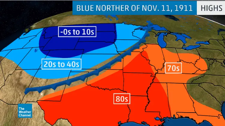
Springfield, Missouri went from 80° to 40° in 10 minutes, hit 13°, and set a record high AND low in same day. This is insane! Here in WCMO, we went from a high temperature of 69 degrees at 6am, to 26° and snow by 6pm. We will see this system again according to the LRC model this spring. We have identified that there are 74 days in the cycle length this year. Within these 74 days, there are 2 phases that cycle through (see picture 2 below):
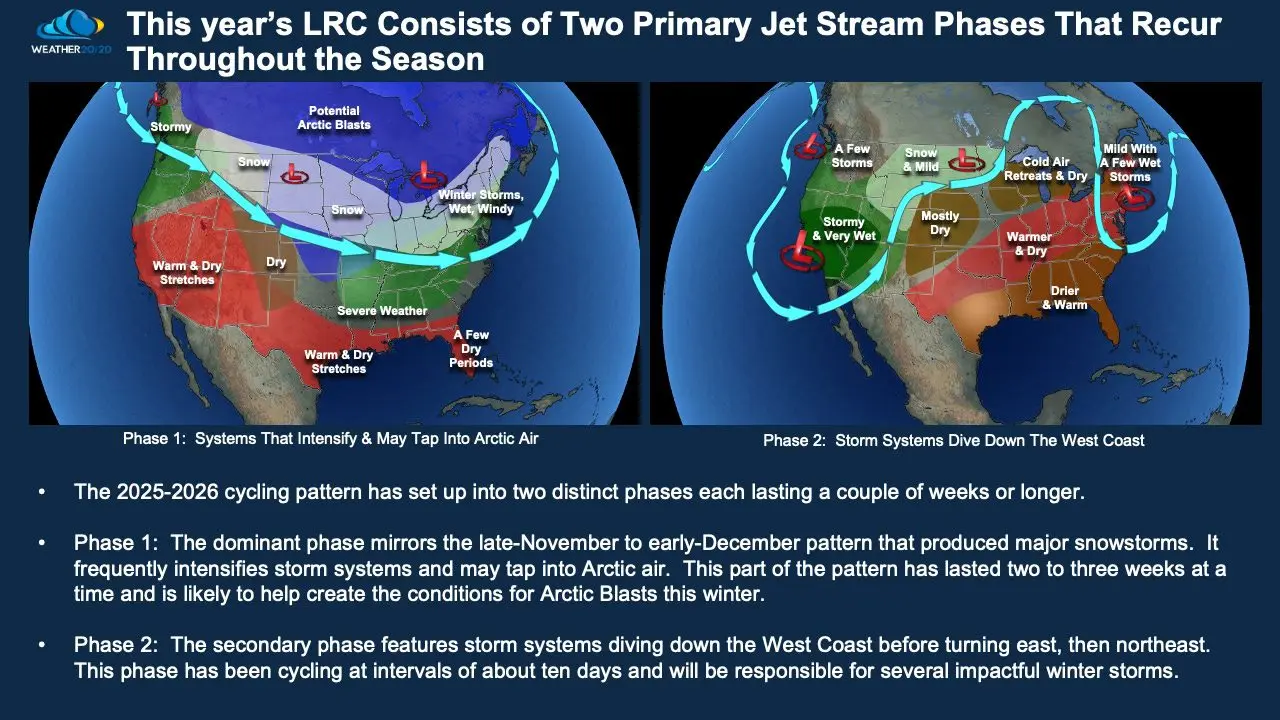
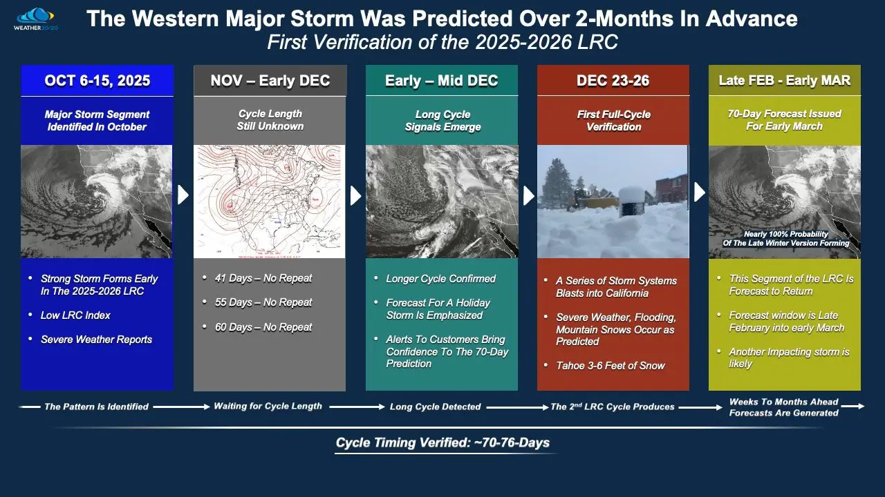
We will see Phase 1 then Phase 2, then a transition back to Phase 1 and Phase 2 in each 74 day cycle. During Phase 1 is where we will likely get our snowfall as well as 2-3 ice events for the season. We have been watching the coast of California closely since October, as the storm systems played a vital role on establishing the LRC cycle this year. First glance was for a 62 day cycle. Now we affirm it is 70-76 days or around a 74 day cycle (picture 3 below):
Here in WCMO, the system that came in on Sunday, December 28th that brought the snow and crashing temperatures will return around March 10th-March 17th and could be a precursor to an early start of severe storm season. This date along with the other dates that I highlighted yesterday are based upon the systems and timing that affected us here in our area. Here are those dates again:
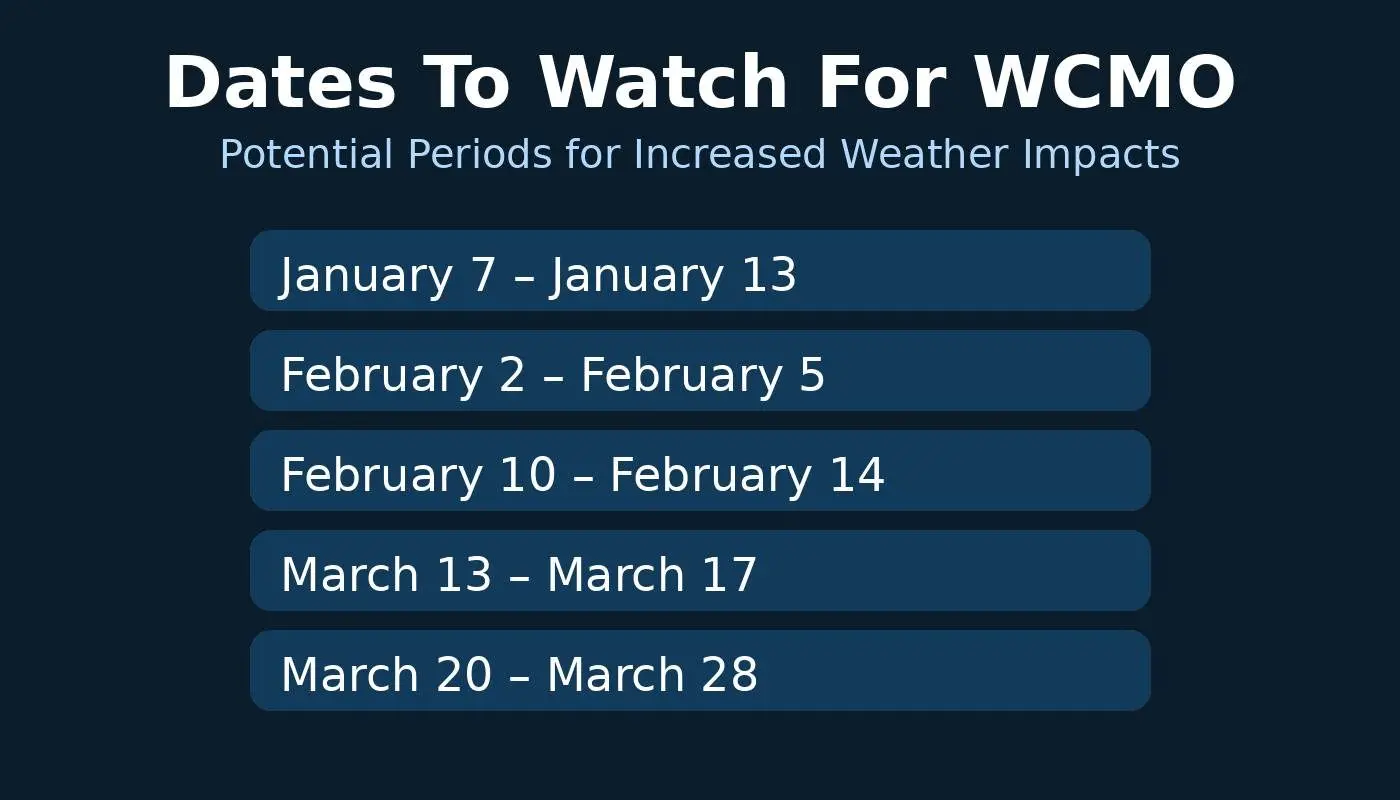
74 days prior to these dates above signify a weather pattern that affected us by producing a strong upper level low that sent our temperatures downward along a cold front and produced t-storms and precipitation. Let’s hope these dates provide some much needed moisture to our fields, as most of WCMO is under a strong Drought Index currently. That’s it for today, have a great rest of your afternoon!! Subby

