


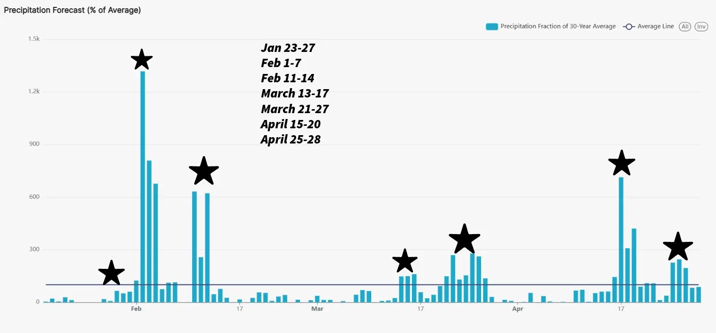
After our biggest winter storm thus far this season dumped a few inches of snow as well as cold Arctic temperatures -15 to -20° below 0 on WCMO, it makes us wonder what is next for us???? If you recall, I posted the latest graph of targeted dates from the LRC last week. I will show it again here:
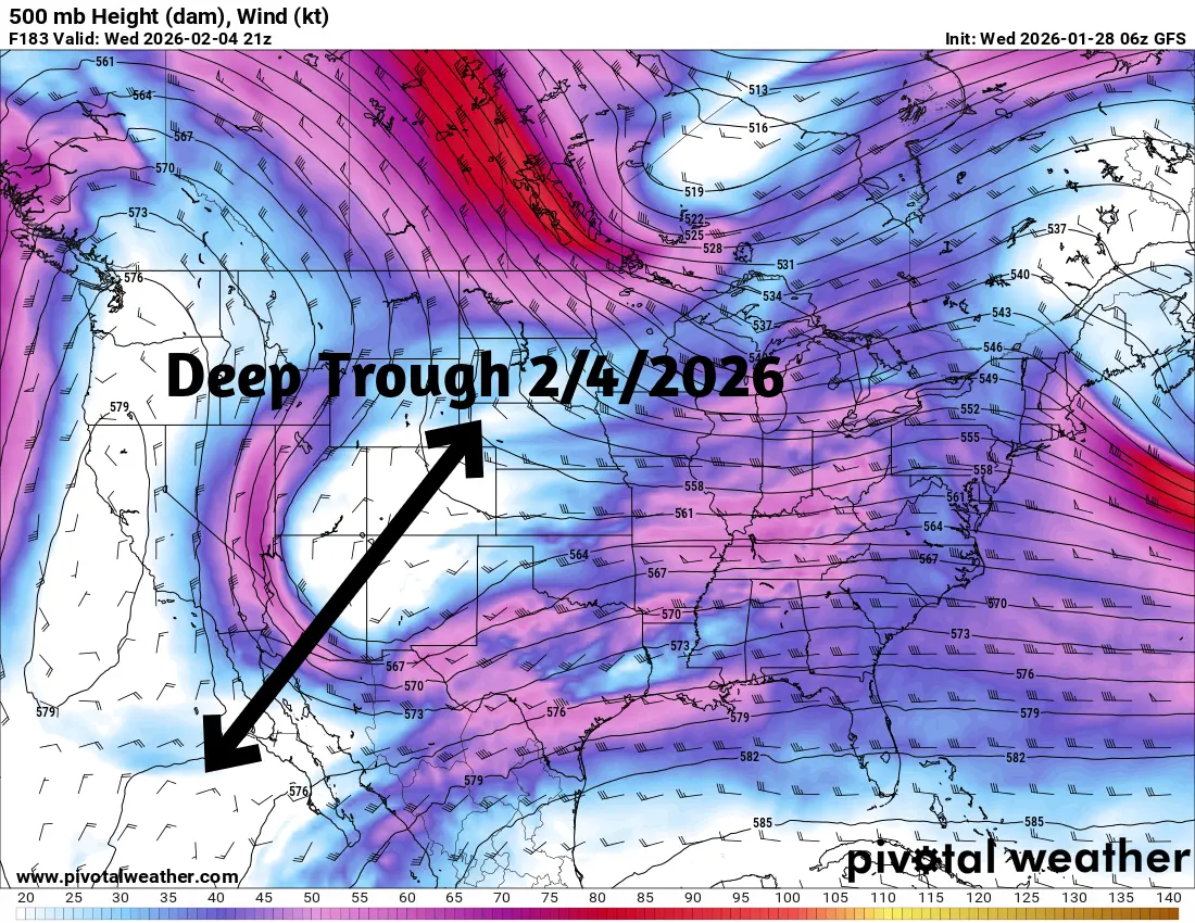
We had the system on the 24th-27th move in and was a weak system, but coupled with the brutal cold Arctic air, turned a small system into our biggest snow producer of the year. The LRC is showing a big system set to arrive around February 3rd through around the 6th. Models are already showing this potential storm brewing a few days ago. Here is what it looks like based on the American GFS data today;
So the LRC is direct on point with the storm system, now we look at the small pieces of the atmospheric puzzle to determine if enough cold air will be present to give us frozen precipitation or rain/thundershowers and where exactly the center of the system will track. Remember, a difference of only 100 miles can make or break a forecast. There is no real time data yet on these small influences so it is a coin flip for right now. I will be keeping eye on the data and update when we have a good handle on this in a few days. For the short term, a cold front will be pushing in overnight on Thursday and will send our temperatures down into negative numbers once again on Saturday morning and near 0° on Sunday morning. We could see a flurry or 2 on Thursday as the cold front works in. Have a great rest of your Wednesday!! Subby

